You are here: Home > Network List > II - Global Seismograph Network (GSN - IRIS/IDA) Stations List
> Station WRAB Tennant Creek, NT, Australia > Earthquake Result Viewer
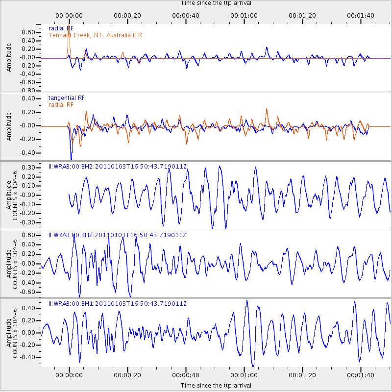
WRAB Tennant Creek, NT, Australia - Earthquake Result Viewer
*The percent match for this event was below the threshold and hence no stack was calculated.
| Earthquake location: |
West Of Macquarie Island |
| Earthquake latitude/longitude: |
-59.8/149.9 |
| Earthquake time(UTC): |
2011/01/03 (003) 16:43:28 GMT |
| Earthquake Depth: |
10 km |
| Earthquake Magnitude: |
5.6 MW |
| Earthquake Catalog/Contributor: |
NEIC PDE/NEIC PDE-M |
|
| Network: |
II Global Seismograph Network (GSN - IRIS/IDA) |
| Station: |
WRAB Tennant Creek, NT, Australia |
| Lat/Lon: |
19.93 S/134.36 E |
| Elevation: |
366 m |
|
| Distance: |
41.3 deg |
| Az: |
337.574 deg |
| Baz: |
168.168 deg |
| Ray Param: |
$rayparam |
*The percent match for this event was below the threshold and hence was not used in the summary stack. |
|
| Radial Match: |
56.450012 % |
| Radial Bump: |
400 |
| Transverse Match: |
73.8532 % |
| Transverse Bump: |
400 |
| SOD ConfigId: |
617450 |
| Insert Time: |
2013-10-01 16:42:42.982 +0000 |
| GWidth: |
2.5 |
| Max Bumps: |
400 |
| Tol: |
0.001 |
|
Signal To Noise
| Channel | StoN | STA | LTA |
| II:WRAB:00:BHZ:20110103T16:50:43.719011Z | 2.256098 | 3.6183172E-7 | 1.6037943E-7 |
| II:WRAB:00:BH1:20110103T16:50:43.719011Z | 1.8937867 | 2.464083E-7 | 1.3011407E-7 |
| II:WRAB:00:BH2:20110103T16:50:43.719011Z | 1.8376856 | 1.9222591E-7 | 1.0460218E-7 |
| Arrivals |
| Ps | |
| PpPs | |
| PsPs/PpSs | |


