You are here: Home > Network List > IU - Global Seismograph Network (GSN - IRIS/USGS) Stations List
> Station RSSD Black Hills, South Dakota, USA > Earthquake Result Viewer
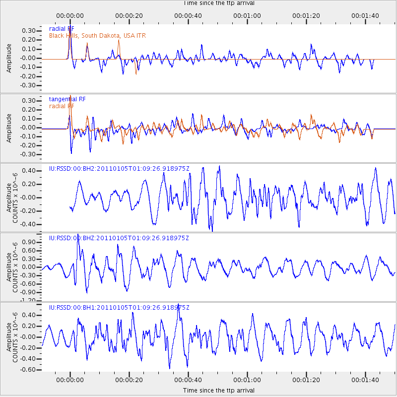
RSSD Black Hills, South Dakota, USA - Earthquake Result Viewer
*The percent match for this event was below the threshold and hence no stack was calculated.
| Earthquake location: |
Southeast Of Honshu, Japan |
| Earthquake latitude/longitude: |
31.5/142.2 |
| Earthquake time(UTC): |
2011/01/05 (005) 00:57:32 GMT |
| Earthquake Depth: |
21 km |
| Earthquake Magnitude: |
6.0 MB, 5.4 MS, 5.6 MW |
| Earthquake Catalog/Contributor: |
WHDF/NEIC |
|
| Network: |
IU Global Seismograph Network (GSN - IRIS/USGS) |
| Station: |
RSSD Black Hills, South Dakota, USA |
| Lat/Lon: |
44.12 N/104.04 W |
| Elevation: |
2090 m |
|
| Distance: |
83.5 deg |
| Az: |
41.551 deg |
| Baz: |
308.158 deg |
| Ray Param: |
$rayparam |
*The percent match for this event was below the threshold and hence was not used in the summary stack. |
|
| Radial Match: |
51.18602 % |
| Radial Bump: |
400 |
| Transverse Match: |
45.647038 % |
| Transverse Bump: |
400 |
| SOD ConfigId: |
617450 |
| Insert Time: |
2013-10-01 16:44:32.987 +0000 |
| GWidth: |
2.5 |
| Max Bumps: |
400 |
| Tol: |
0.001 |
|
Signal To Noise
| Channel | StoN | STA | LTA |
| IU:RSSD:00:BHZ:20110105T01:09:26.918975Z | 2.8239167 | 4.895005E-7 | 1.7334098E-7 |
| IU:RSSD:00:BH1:20110105T01:09:26.918975Z | 1.0215492 | 1.9044762E-7 | 1.864302E-7 |
| IU:RSSD:00:BH2:20110105T01:09:26.918975Z | 1.8852993 | 2.0532322E-7 | 1.08907486E-7 |
| Arrivals |
| Ps | |
| PpPs | |
| PsPs/PpSs | |


