You are here: Home > Network List > II - Global Seismograph Network (GSN - IRIS/IDA) Stations List
> Station WRAB Tennant Creek, NT, Australia > Earthquake Result Viewer
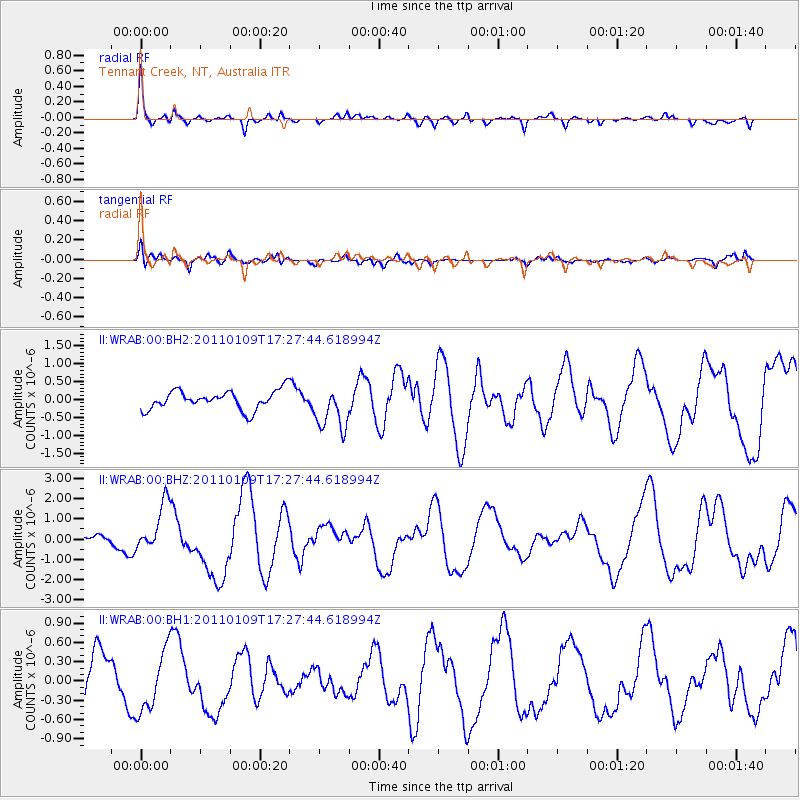
WRAB Tennant Creek, NT, Australia - Earthquake Result Viewer
*The percent match for this event was below the threshold and hence no stack was calculated.
| Earthquake location: |
Vanuatu Islands |
| Earthquake latitude/longitude: |
-19.2/168.2 |
| Earthquake time(UTC): |
2011/01/09 (009) 17:21:51 GMT |
| Earthquake Depth: |
18 km |
| Earthquake Magnitude: |
5.7 MB, 6.1 MS, 6.2 MW, 6.1 MW |
| Earthquake Catalog/Contributor: |
WHDF/NEIC |
|
| Network: |
II Global Seismograph Network (GSN - IRIS/IDA) |
| Station: |
WRAB Tennant Creek, NT, Australia |
| Lat/Lon: |
19.93 S/134.36 E |
| Elevation: |
366 m |
|
| Distance: |
31.8 deg |
| Az: |
262.953 deg |
| Baz: |
94.503 deg |
| Ray Param: |
$rayparam |
*The percent match for this event was below the threshold and hence was not used in the summary stack. |
|
| Radial Match: |
71.49461 % |
| Radial Bump: |
322 |
| Transverse Match: |
78.25368 % |
| Transverse Bump: |
400 |
| SOD ConfigId: |
617450 |
| Insert Time: |
2013-10-01 16:59:41.933 +0000 |
| GWidth: |
2.5 |
| Max Bumps: |
400 |
| Tol: |
0.001 |
|
Signal To Noise
| Channel | StoN | STA | LTA |
| II:WRAB:00:BHZ:20110109T17:27:44.618994Z | 4.9964905 | 1.2028837E-6 | 2.4074572E-7 |
| II:WRAB:00:BH1:20110109T17:27:44.618994Z | 1.5955056 | 4.736895E-7 | 2.968899E-7 |
| II:WRAB:00:BH2:20110109T17:27:44.618994Z | 2.378681 | 6.234664E-7 | 2.6210594E-7 |
| Arrivals |
| Ps | |
| PpPs | |
| PsPs/PpSs | |


