You are here: Home > Network List > IU - Global Seismograph Network (GSN - IRIS/USGS) Stations List
> Station KEV Kevo, Finland > Earthquake Result Viewer
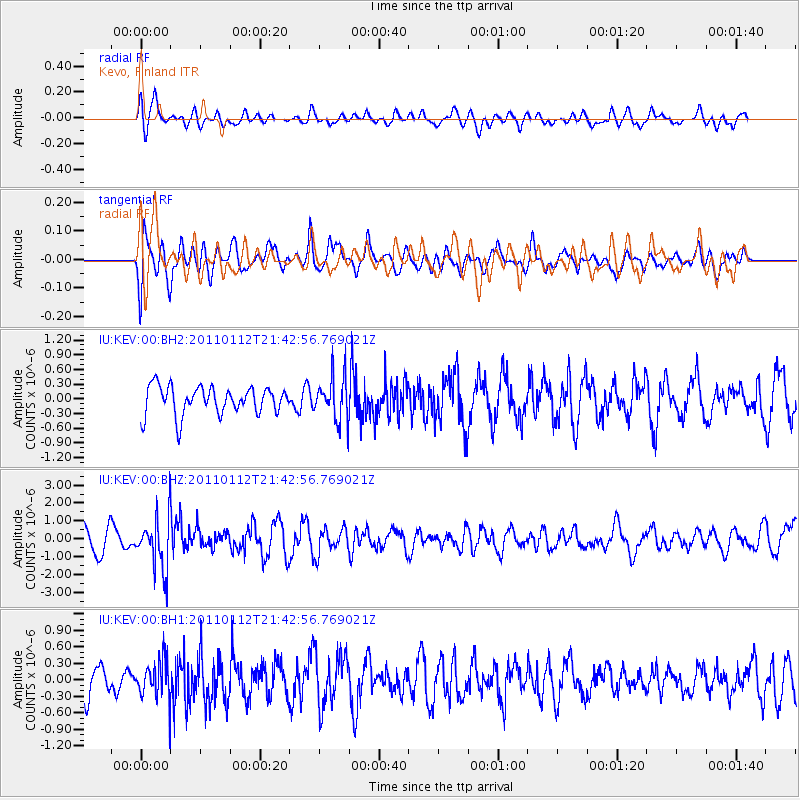
KEV Kevo, Finland - Earthquake Result Viewer
*The percent match for this event was below the threshold and hence no stack was calculated.
| Earthquake location: |
Bonin Islands, Japan Region |
| Earthquake latitude/longitude: |
27.0/139.9 |
| Earthquake time(UTC): |
2011/01/12 (012) 21:32:55 GMT |
| Earthquake Depth: |
528 km |
| Earthquake Magnitude: |
6.2 MB, 6.5 MW, 6.5 MW |
| Earthquake Catalog/Contributor: |
WHDF/NEIC |
|
| Network: |
IU Global Seismograph Network (GSN - IRIS/USGS) |
| Station: |
KEV Kevo, Finland |
| Lat/Lon: |
69.76 N/27.00 E |
| Elevation: |
100 m |
|
| Distance: |
72.4 deg |
| Az: |
340.339 deg |
| Baz: |
59.615 deg |
| Ray Param: |
$rayparam |
*The percent match for this event was below the threshold and hence was not used in the summary stack. |
|
| Radial Match: |
53.72768 % |
| Radial Bump: |
400 |
| Transverse Match: |
57.516457 % |
| Transverse Bump: |
400 |
| SOD ConfigId: |
617450 |
| Insert Time: |
2013-10-01 17:11:18.571 +0000 |
| GWidth: |
2.5 |
| Max Bumps: |
400 |
| Tol: |
0.001 |
|
Signal To Noise
| Channel | StoN | STA | LTA |
| IU:KEV:00:BHZ:20110112T21:42:56.769021Z | 1.840878 | 1.4510495E-6 | 7.8823774E-7 |
| IU:KEV:00:BH1:20110112T21:42:56.769021Z | 1.0199068 | 3.4986414E-7 | 3.4303542E-7 |
| IU:KEV:00:BH2:20110112T21:42:56.769021Z | 1.4822049 | 4.2426174E-7 | 2.862369E-7 |
| Arrivals |
| Ps | |
| PpPs | |
| PsPs/PpSs | |


