You are here: Home > Network List > II - Global Seismograph Network (GSN - IRIS/IDA) Stations List
> Station HOPE Hope Point, South Georgia Island > Earthquake Result Viewer
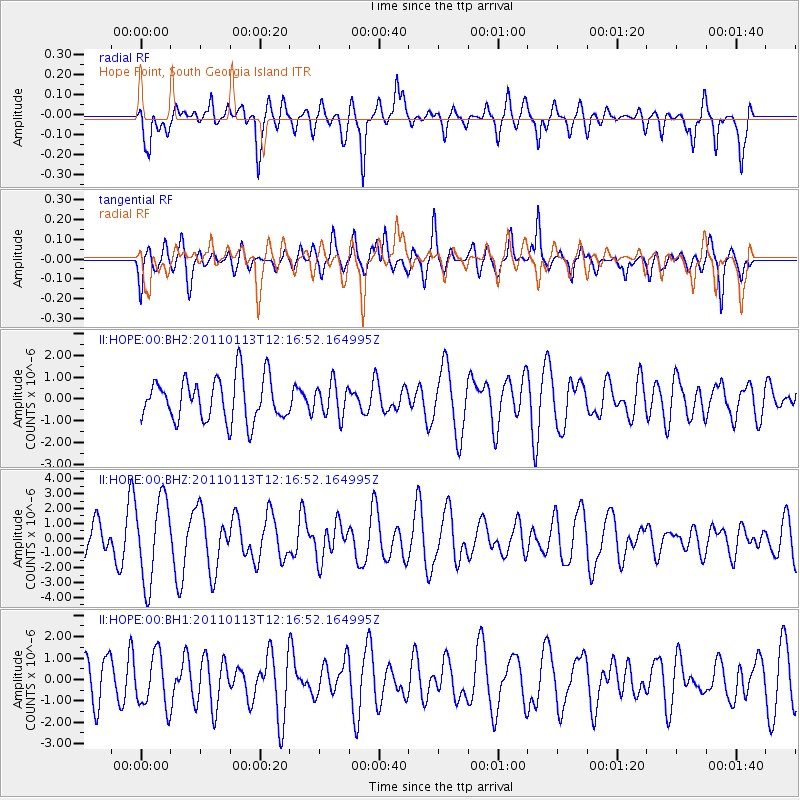
HOPE Hope Point, South Georgia Island - Earthquake Result Viewer
*The percent match for this event was below the threshold and hence no stack was calculated.
| Earthquake location: |
Off E. Coast Of N. Island, N.Z. |
| Earthquake latitude/longitude: |
-36.9/179.5 |
| Earthquake time(UTC): |
2011/01/13 (013) 12:04:56 GMT |
| Earthquake Depth: |
35 km |
| Earthquake Magnitude: |
5.5 MW, 5.5 MB, 5.5 ML |
| Earthquake Catalog/Contributor: |
NEIC PDE/NEIC PDE-M |
|
| Network: |
II Global Seismograph Network (GSN - IRIS/IDA) |
| Station: |
HOPE Hope Point, South Georgia Island |
| Lat/Lon: |
54.28 S/36.49 W |
| Elevation: |
20 m |
|
| Distance: |
84.0 deg |
| Az: |
159.751 deg |
| Baz: |
208.231 deg |
| Ray Param: |
$rayparam |
*The percent match for this event was below the threshold and hence was not used in the summary stack. |
|
| Radial Match: |
66.17369 % |
| Radial Bump: |
377 |
| Transverse Match: |
52.7972 % |
| Transverse Bump: |
400 |
| SOD ConfigId: |
617450 |
| Insert Time: |
2013-10-01 17:12:48.472 +0000 |
| GWidth: |
2.5 |
| Max Bumps: |
400 |
| Tol: |
0.001 |
|
Signal To Noise
| Channel | StoN | STA | LTA |
| II:HOPE:00:BHZ:20110113T12:16:52.164995Z | 3.9788997 | 2.7964054E-6 | 7.028087E-7 |
| II:HOPE:00:BH1:20110113T12:16:52.164995Z | 1.412536 | 1.2533943E-6 | 8.873362E-7 |
| II:HOPE:00:BH2:20110113T12:16:52.164995Z | 0.7608959 | 7.472965E-7 | 9.821272E-7 |
| Arrivals |
| Ps | |
| PpPs | |
| PsPs/PpSs | |


