You are here: Home > Network List > TA - USArray Transportable Network (new EarthScope stations) Stations List
> Station R11A Troy Canyon, Currant, NV, USA > Earthquake Result Viewer
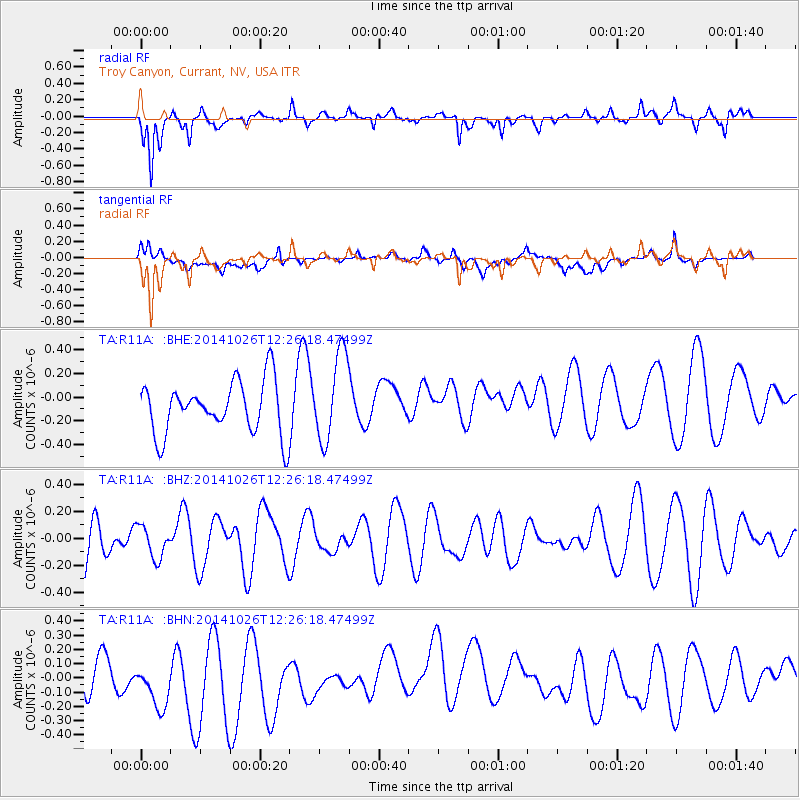
R11A Troy Canyon, Currant, NV, USA - Earthquake Result Viewer
*The percent match for this event was below the threshold and hence no stack was calculated.
| Earthquake location: |
New Britain Region, P.N.G. |
| Earthquake latitude/longitude: |
-5.4/150.5 |
| Earthquake time(UTC): |
2014/10/26 (299) 12:13:24 GMT |
| Earthquake Depth: |
35 km |
| Earthquake Magnitude: |
5.3 MW |
| Earthquake Catalog/Contributor: |
ISC/ISC |
|
| Network: |
TA USArray Transportable Network (new EarthScope stations) |
| Station: |
R11A Troy Canyon, Currant, NV, USA |
| Lat/Lon: |
38.35 N/115.59 W |
| Elevation: |
1756 m |
|
| Distance: |
96.4 deg |
| Az: |
52.122 deg |
| Baz: |
268.203 deg |
| Ray Param: |
$rayparam |
*The percent match for this event was below the threshold and hence was not used in the summary stack. |
|
| Radial Match: |
65.5868 % |
| Radial Bump: |
310 |
| Transverse Match: |
27.498018 % |
| Transverse Bump: |
400 |
| SOD ConfigId: |
3390531 |
| Insert Time: |
2019-04-14 18:33:40.538 +0000 |
| GWidth: |
2.5 |
| Max Bumps: |
400 |
| Tol: |
0.001 |
|
Signal To Noise
| Channel | StoN | STA | LTA |
| TA:R11A: :BHZ:20141026T12:26:18.47499Z | 0.43674114 | 1.1957997E-7 | 2.7380057E-7 |
| TA:R11A: :BHN:20141026T12:26:18.47499Z | 1.5479555 | 2.6007737E-7 | 1.6801346E-7 |
| TA:R11A: :BHE:20141026T12:26:18.47499Z | 1.6743482 | 3.703411E-7 | 2.2118522E-7 |
| Arrivals |
| Ps | |
| PpPs | |
| PsPs/PpSs | |


