You are here: Home > Network List > II - Global Seismograph Network (GSN - IRIS/IDA) Stations List
> Station WRAB Tennant Creek, NT, Australia > Earthquake Result Viewer
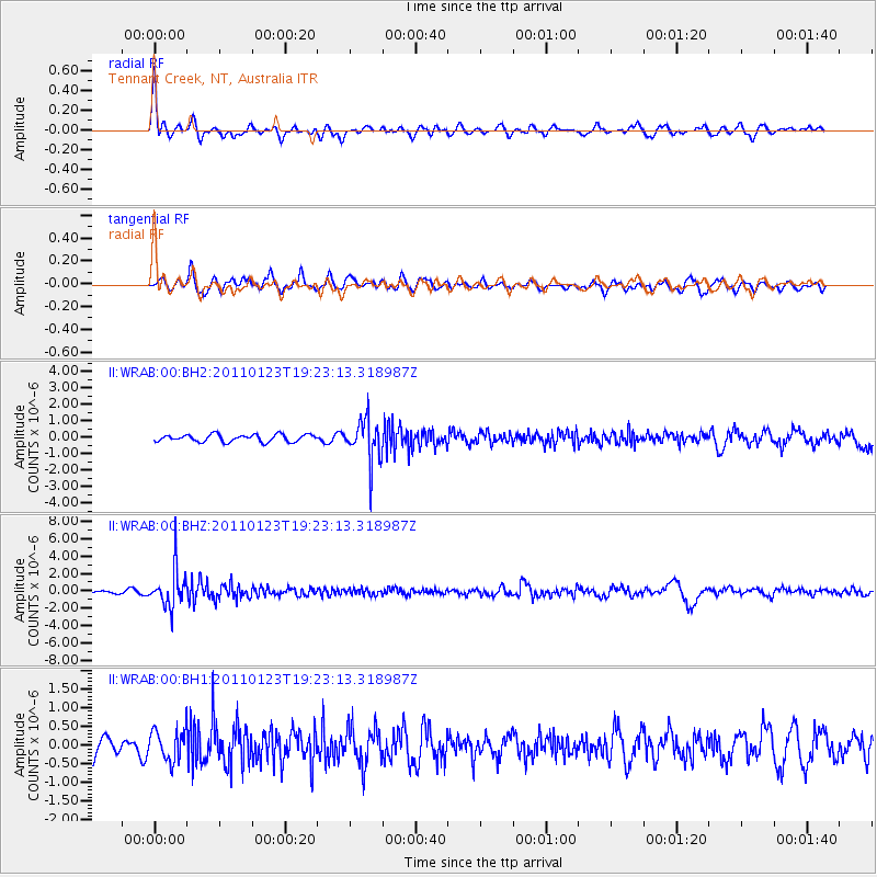
WRAB Tennant Creek, NT, Australia - Earthquake Result Viewer
*The percent match for this event was below the threshold and hence no stack was calculated.
| Earthquake location: |
Fiji Islands Region |
| Earthquake latitude/longitude: |
-20.3/-176.3 |
| Earthquake time(UTC): |
2011/01/23 (023) 19:15:42 GMT |
| Earthquake Depth: |
236 km |
| Earthquake Magnitude: |
5.7 MB, 5.9 MW, 5.9 MW |
| Earthquake Catalog/Contributor: |
WHDF/NEIC |
|
| Network: |
II Global Seismograph Network (GSN - IRIS/IDA) |
| Station: |
WRAB Tennant Creek, NT, Australia |
| Lat/Lon: |
19.93 S/134.36 E |
| Elevation: |
366 m |
|
| Distance: |
46.2 deg |
| Az: |
261.529 deg |
| Baz: |
99.396 deg |
| Ray Param: |
$rayparam |
*The percent match for this event was below the threshold and hence was not used in the summary stack. |
|
| Radial Match: |
68.01208 % |
| Radial Bump: |
381 |
| Transverse Match: |
62.900803 % |
| Transverse Bump: |
400 |
| SOD ConfigId: |
617450 |
| Insert Time: |
2013-10-01 17:33:28.656 +0000 |
| GWidth: |
2.5 |
| Max Bumps: |
400 |
| Tol: |
0.001 |
|
Signal To Noise
| Channel | StoN | STA | LTA |
| II:WRAB:00:BHZ:20110123T19:23:13.318987Z | 8.550328 | 2.086296E-6 | 2.4400185E-7 |
| II:WRAB:00:BH1:20110123T19:23:13.318987Z | 1.2227987 | 4.1297085E-7 | 3.3772594E-7 |
| II:WRAB:00:BH2:20110123T19:23:13.318987Z | 5.55984 | 1.2248025E-6 | 2.2029457E-7 |
| Arrivals |
| Ps | |
| PpPs | |
| PsPs/PpSs | |


