You are here: Home > Network List > II - Global Seismograph Network (GSN - IRIS/IDA) Stations List
> Station WRAB Tennant Creek, NT, Australia > Earthquake Result Viewer
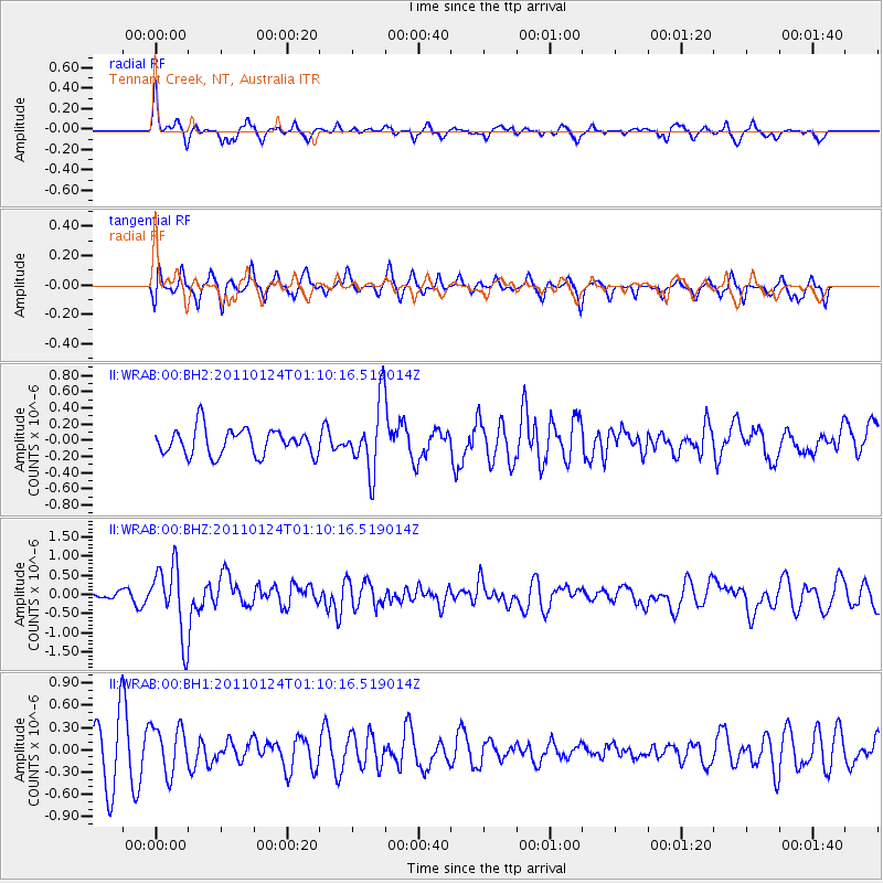
WRAB Tennant Creek, NT, Australia - Earthquake Result Viewer
*The percent match for this event was below the threshold and hence no stack was calculated.
| Earthquake location: |
Tonga Islands |
| Earthquake latitude/longitude: |
-19.2/-173.5 |
| Earthquake time(UTC): |
2011/01/24 (024) 01:02:02 GMT |
| Earthquake Depth: |
16 km |
| Earthquake Magnitude: |
5.5 MB, 5.8 MS, 5.7 MW, 5.7 MW |
| Earthquake Catalog/Contributor: |
WHDF/NEIC |
|
| Network: |
II Global Seismograph Network (GSN - IRIS/IDA) |
| Station: |
WRAB Tennant Creek, NT, Australia |
| Lat/Lon: |
19.93 S/134.36 E |
| Elevation: |
366 m |
|
| Distance: |
49.0 deg |
| Az: |
259.963 deg |
| Baz: |
98.463 deg |
| Ray Param: |
$rayparam |
*The percent match for this event was below the threshold and hence was not used in the summary stack. |
|
| Radial Match: |
66.217094 % |
| Radial Bump: |
352 |
| Transverse Match: |
49.30972 % |
| Transverse Bump: |
392 |
| SOD ConfigId: |
617450 |
| Insert Time: |
2013-10-01 17:35:17.176 +0000 |
| GWidth: |
2.5 |
| Max Bumps: |
400 |
| Tol: |
0.001 |
|
Signal To Noise
| Channel | StoN | STA | LTA |
| II:WRAB:00:BHZ:20110124T01:10:16.519014Z | 4.451689 | 9.0574747E-7 | 2.0346154E-7 |
| II:WRAB:00:BH1:20110124T01:10:16.519014Z | 0.90941685 | 3.192601E-7 | 3.510602E-7 |
| II:WRAB:00:BH2:20110124T01:10:16.519014Z | 2.5796456 | 4.2366938E-7 | 1.642355E-7 |
| Arrivals |
| Ps | |
| PpPs | |
| PsPs/PpSs | |


