You are here: Home > Network List > II - Global Seismograph Network (GSN - IRIS/IDA) Stations List
> Station CMLA Cha de Macela, Sao Miguel Island, Azores > Earthquake Result Viewer
CMLA Cha de Macela, Sao Miguel Island, Azores - Earthquake Result Viewer
*The percent match for this event was below the threshold and hence no stack was calculated.
| Earthquake location: |
Jan Mayen Island Region |
| Earthquake latitude/longitude: |
70.9/-6.7 |
| Earthquake time(UTC): |
2011/01/29 (029) 06:55:26 GMT |
| Earthquake Depth: |
6.0 km |
| Earthquake Magnitude: |
6.1 MB, 6.1 MS, 6.2 MW, 6.2 MW |
| Earthquake Catalog/Contributor: |
WHDF/NEIC |
|
| Network: |
II Global Seismograph Network (GSN - IRIS/IDA) |
| Station: |
CMLA Cha de Macela, Sao Miguel Island, Azores |
| Lat/Lon: |
37.76 N/25.52 W |
| Elevation: |
429 m |
|
| Distance: |
34.7 deg |
| Az: |
206.744 deg |
| Baz: |
10.753 deg |
| Ray Param: |
$rayparam |
*The percent match for this event was below the threshold and hence was not used in the summary stack. |
|
| Radial Match: |
50.822365 % |
| Radial Bump: |
400 |
| Transverse Match: |
57.198788 % |
| Transverse Bump: |
400 |
| SOD ConfigId: |
617450 |
| Insert Time: |
2013-10-01 17:52:37.223 +0000 |
| GWidth: |
2.5 |
| Max Bumps: |
400 |
| Tol: |
0.001 |
|
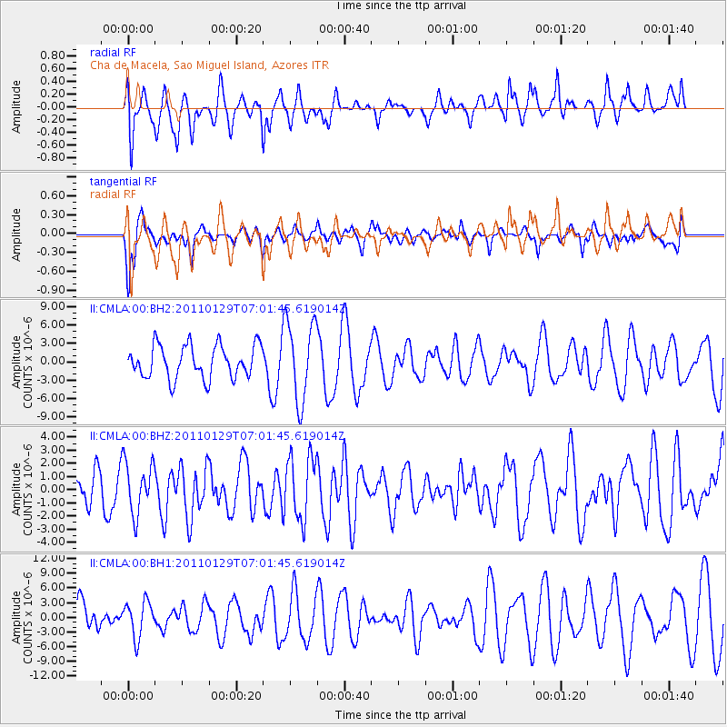
Signal To Noise
| Channel | StoN | STA | LTA |
| II:CMLA:00:BHZ:20110129T07:01:45.619014Z | 1.5262185 | 1.9544398E-6 | 1.2805767E-6 |
| II:CMLA:00:BH1:20110129T07:01:45.619014Z | 0.9124358 | 3.6691422E-6 | 4.0212603E-6 |
| II:CMLA:00:BH2:20110129T07:01:45.619014Z | 2.4527729 | 6.518791E-6 | 2.6577231E-6 |
| Arrivals |
| Ps | |
| PpPs | |
| PsPs/PpSs | |


