You are here: Home > Network List > IU - Global Seismograph Network (GSN - IRIS/USGS) Stations List
> Station JOHN Johnston Island, USA > Earthquake Result Viewer
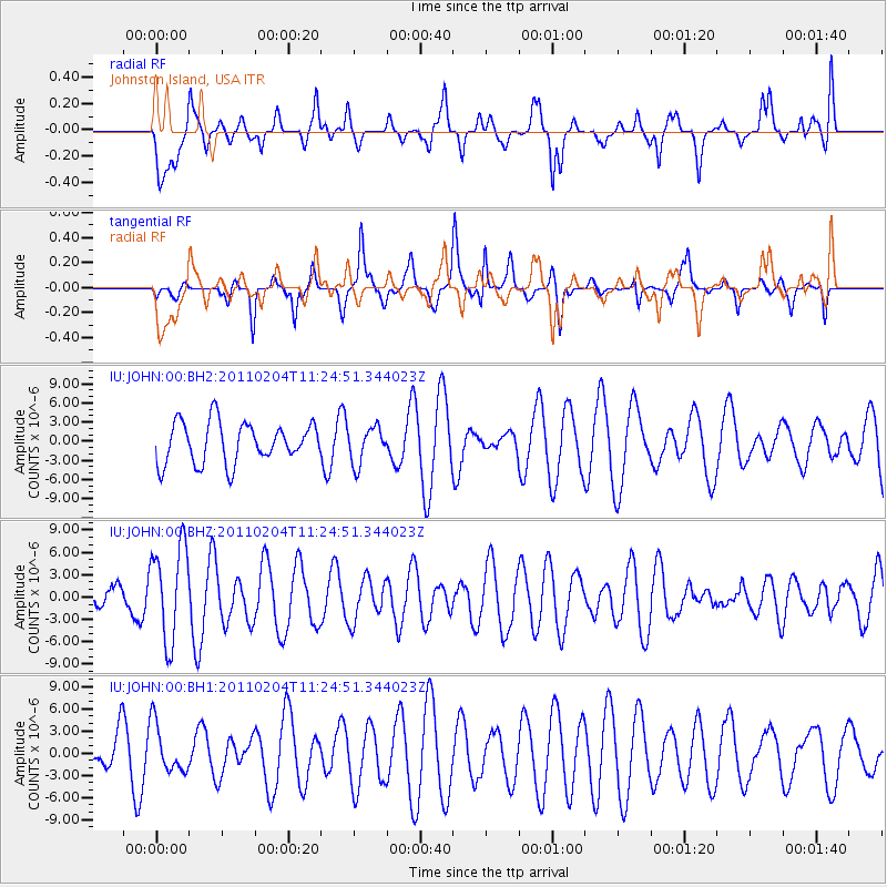
JOHN Johnston Island, USA - Earthquake Result Viewer
*The percent match for this event was below the threshold and hence no stack was calculated.
| Earthquake location: |
Ryukyu Islands, Japan |
| Earthquake latitude/longitude: |
29.2/130.2 |
| Earthquake time(UTC): |
2011/02/04 (035) 11:15:45 GMT |
| Earthquake Depth: |
42 km |
| Earthquake Magnitude: |
5.7 MB |
| Earthquake Catalog/Contributor: |
NEIC PDE/NEIC PDE-M |
|
| Network: |
IU Global Seismograph Network (GSN - IRIS/USGS) |
| Station: |
JOHN Johnston Island, USA |
| Lat/Lon: |
16.73 N/169.53 W |
| Elevation: |
2.0 m |
|
| Distance: |
56.3 deg |
| Az: |
88.655 deg |
| Baz: |
294.165 deg |
| Ray Param: |
$rayparam |
*The percent match for this event was below the threshold and hence was not used in the summary stack. |
|
| Radial Match: |
66.9012 % |
| Radial Bump: |
400 |
| Transverse Match: |
61.79446 % |
| Transverse Bump: |
290 |
| SOD ConfigId: |
617450 |
| Insert Time: |
2013-10-01 18:06:20.863 +0000 |
| GWidth: |
2.5 |
| Max Bumps: |
400 |
| Tol: |
0.001 |
|
Signal To Noise
| Channel | StoN | STA | LTA |
| IU:JOHN:00:BHZ:20110204T11:24:51.344023Z | 1.72086 | 6.4532537E-6 | 3.7500167E-6 |
| IU:JOHN:00:BH1:20110204T11:24:51.344023Z | 0.9131477 | 3.2863788E-6 | 3.5989565E-6 |
| IU:JOHN:00:BH2:20110204T11:24:51.344023Z | 0.90257585 | 2.8547245E-6 | 3.1628638E-6 |
| Arrivals |
| Ps | |
| PpPs | |
| PsPs/PpSs | |


