You are here: Home > Network List > II - Global Seismograph Network (GSN - IRIS/IDA) Stations List
> Station ABPO Ambohimpanompo, Madagascar > Earthquake Result Viewer
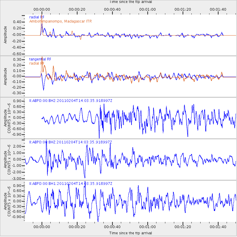
ABPO Ambohimpanompo, Madagascar - Earthquake Result Viewer
*The percent match for this event was below the threshold and hence no stack was calculated.
| Earthquake location: |
Myanmar-India Border Region |
| Earthquake latitude/longitude: |
24.6/94.7 |
| Earthquake time(UTC): |
2011/02/04 (035) 13:53:46 GMT |
| Earthquake Depth: |
85 km |
| Earthquake Magnitude: |
6.2 MW, 6.2 MW, 6.4 MB |
| Earthquake Catalog/Contributor: |
NEIC PDE/NEIC PDE-M |
|
| Network: |
II Global Seismograph Network (GSN - IRIS/IDA) |
| Station: |
ABPO Ambohimpanompo, Madagascar |
| Lat/Lon: |
19.02 S/47.23 E |
| Elevation: |
1528 m |
|
| Distance: |
63.4 deg |
| Az: |
231.227 deg |
| Baz: |
48.593 deg |
| Ray Param: |
$rayparam |
*The percent match for this event was below the threshold and hence was not used in the summary stack. |
|
| Radial Match: |
66.604965 % |
| Radial Bump: |
400 |
| Transverse Match: |
61.64887 % |
| Transverse Bump: |
400 |
| SOD ConfigId: |
617450 |
| Insert Time: |
2013-10-01 18:07:52.640 +0000 |
| GWidth: |
2.5 |
| Max Bumps: |
400 |
| Tol: |
0.001 |
|
Signal To Noise
| Channel | StoN | STA | LTA |
| II:ABPO:00:BHZ:20110204T14:03:35.918997Z | 2.7327168 | 1.06194E-6 | 3.8860233E-7 |
| II:ABPO:00:BH1:20110204T14:03:35.918997Z | 1.2601413 | 3.9528356E-7 | 3.1368197E-7 |
| II:ABPO:00:BH2:20110204T14:03:35.918997Z | 1.999069 | 3.5992895E-7 | 1.8004829E-7 |
| Arrivals |
| Ps | |
| PpPs | |
| PsPs/PpSs | |


