You are here: Home > Network List > IU - Global Seismograph Network (GSN - IRIS/USGS) Stations List
> Station HNR Honiara, Solomon Islands > Earthquake Result Viewer
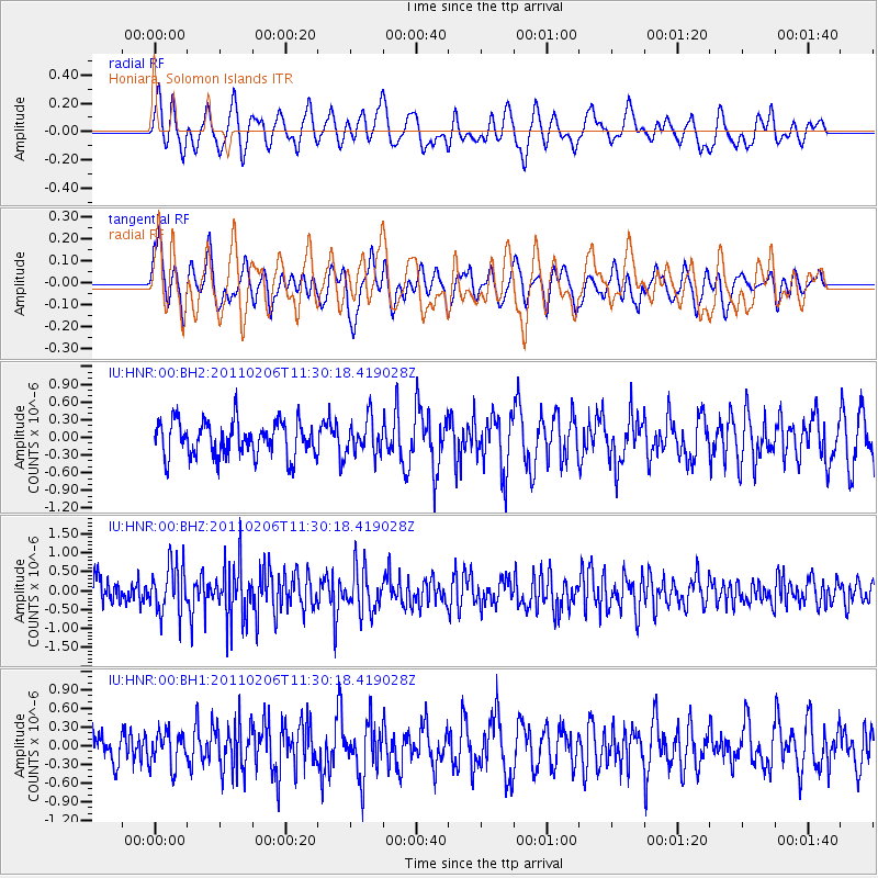
HNR Honiara, Solomon Islands - Earthquake Result Viewer
*The percent match for this event was below the threshold and hence no stack was calculated.
| Earthquake location: |
Southwest Of Sumatra, Indonesia |
| Earthquake latitude/longitude: |
-8.3/104.1 |
| Earthquake time(UTC): |
2011/02/06 (037) 11:21:17 GMT |
| Earthquake Depth: |
13 km |
| Earthquake Magnitude: |
5.6 MB, 5.2 MS, 5.7 MW, 5.6 MW |
| Earthquake Catalog/Contributor: |
WHDF/NEIC |
|
| Network: |
IU Global Seismograph Network (GSN - IRIS/USGS) |
| Station: |
HNR Honiara, Solomon Islands |
| Lat/Lon: |
9.44 S/159.95 E |
| Elevation: |
100 m |
|
| Distance: |
55.2 deg |
| Az: |
95.741 deg |
| Baz: |
266.467 deg |
| Ray Param: |
$rayparam |
*The percent match for this event was below the threshold and hence was not used in the summary stack. |
|
| Radial Match: |
59.61318 % |
| Radial Bump: |
400 |
| Transverse Match: |
62.0615 % |
| Transverse Bump: |
400 |
| SOD ConfigId: |
617450 |
| Insert Time: |
2013-10-01 18:13:46.337 +0000 |
| GWidth: |
2.5 |
| Max Bumps: |
400 |
| Tol: |
0.001 |
|
Signal To Noise
| Channel | StoN | STA | LTA |
| IU:HNR:00:BHZ:20110206T11:30:18.419028Z | 1.962379 | 6.5764834E-7 | 3.351281E-7 |
| IU:HNR:00:BH1:20110206T11:30:18.419028Z | 1.154899 | 2.733175E-7 | 2.3665923E-7 |
| IU:HNR:00:BH2:20110206T11:30:18.419028Z | 1.0310163 | 3.028872E-7 | 2.9377537E-7 |
| Arrivals |
| Ps | |
| PpPs | |
| PsPs/PpSs | |


