You are here: Home > Network List > PF - Volcanologic Network of Piton de Fournaise-OVPF Stations List
> Station HIM cratere Himiltrude > Earthquake Result Viewer
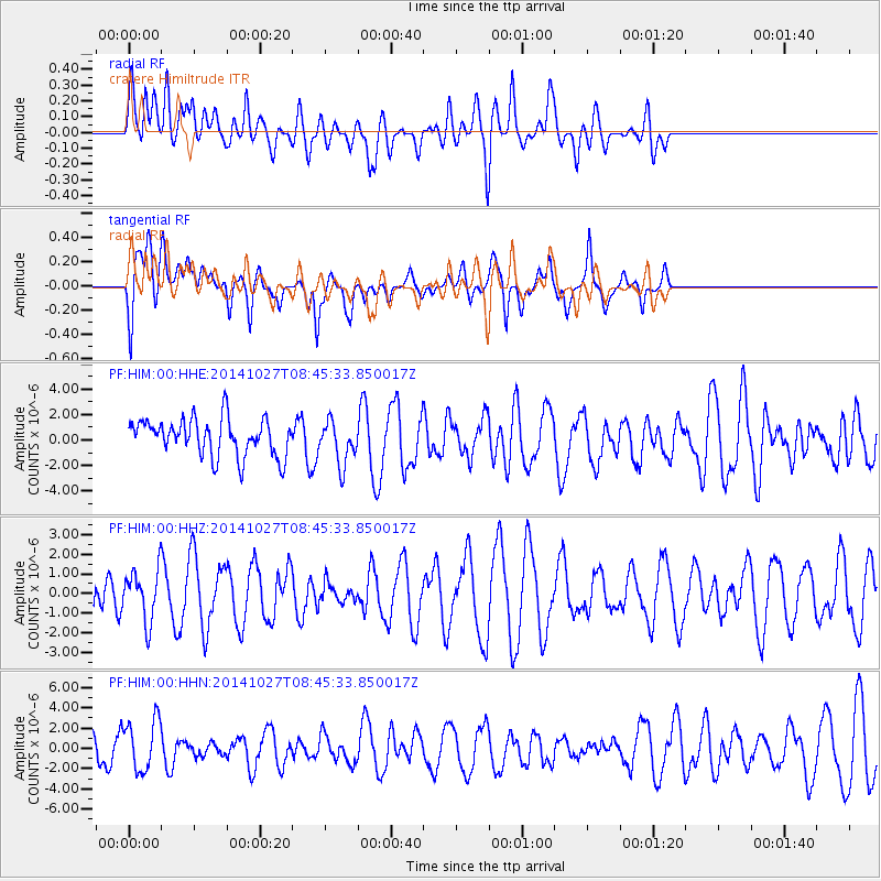
HIM cratere Himiltrude - Earthquake Result Viewer
*The percent match for this event was below the threshold and hence no stack was calculated.
| Earthquake location: |
Mindanao, Philippines |
| Earthquake latitude/longitude: |
9.7/126.8 |
| Earthquake time(UTC): |
2014/10/27 (300) 08:34:19 GMT |
| Earthquake Depth: |
35 km |
| Earthquake Magnitude: |
5.5 MWC, 5.5 MWC |
| Earthquake Catalog/Contributor: |
NEIC PDE/NEIC COMCAT |
|
| Network: |
PF Volcanologic Network of Piton de Fournaise-OVPF |
| Station: |
HIM cratere Himiltrude |
| Lat/Lon: |
21.21 S/55.72 E |
| Elevation: |
1958 m |
|
| Distance: |
76.2 deg |
| Az: |
245.321 deg |
| Baz: |
73.734 deg |
| Ray Param: |
$rayparam |
*The percent match for this event was below the threshold and hence was not used in the summary stack. |
|
| Radial Match: |
37.03492 % |
| Radial Bump: |
400 |
| Transverse Match: |
59.357445 % |
| Transverse Bump: |
400 |
| SOD ConfigId: |
3390531 |
| Insert Time: |
2019-04-14 18:43:48.432 +0000 |
| GWidth: |
2.5 |
| Max Bumps: |
400 |
| Tol: |
0.001 |
|
Signal To Noise
| Channel | StoN | STA | LTA |
| PF:HIM:00:HHZ:20141027T08:45:33.850017Z | 0.8229969 | 1.2993643E-6 | 1.5788203E-6 |
| PF:HIM:00:HHN:20141027T08:45:33.850017Z | 1.9969825 | 2.5287193E-6 | 1.2662701E-6 |
| PF:HIM:00:HHE:20141027T08:45:33.850017Z | 1.1642792 | 1.6987634E-6 | 1.4590688E-6 |
| Arrivals |
| Ps | |
| PpPs | |
| PsPs/PpSs | |


