You are here: Home > Network List > IU - Global Seismograph Network (GSN - IRIS/USGS) Stations List
> Station HNR Honiara, Solomon Islands > Earthquake Result Viewer
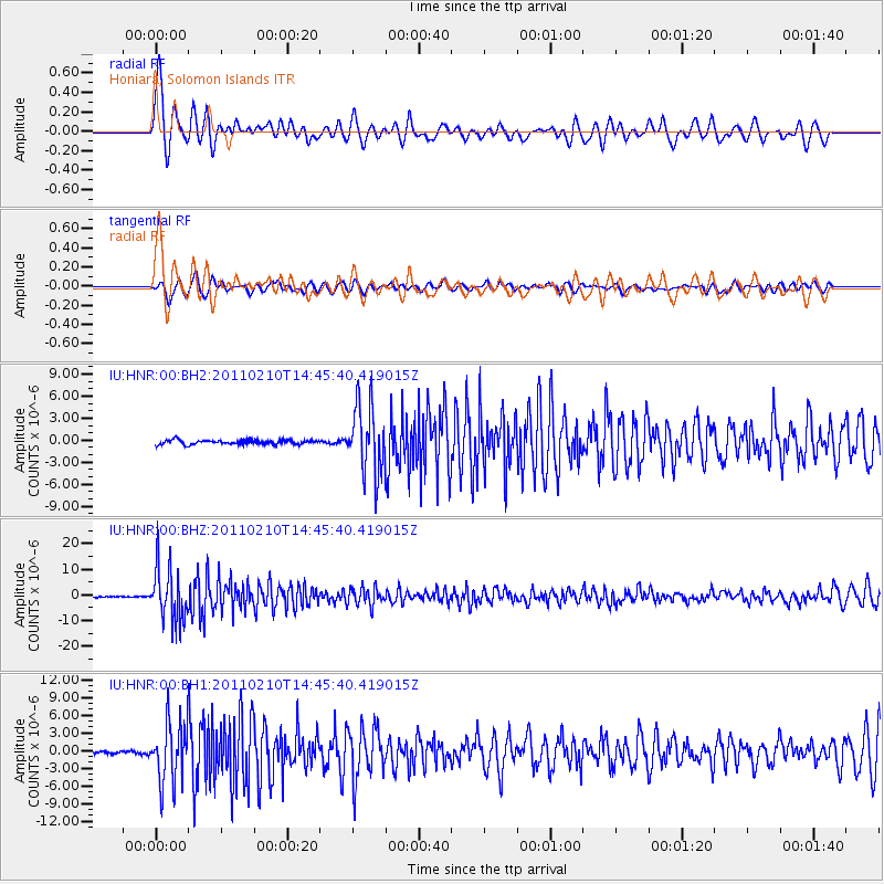
HNR Honiara, Solomon Islands - Earthquake Result Viewer
*The percent match for this event was below the threshold and hence no stack was calculated.
| Earthquake location: |
Celebes Sea |
| Earthquake latitude/longitude: |
4.2/123.0 |
| Earthquake time(UTC): |
2011/02/10 (041) 14:39:27 GMT |
| Earthquake Depth: |
523 km |
| Earthquake Magnitude: |
6.1 MB, 6.5 MW, 6.5 MW |
| Earthquake Catalog/Contributor: |
WHDF/NEIC |
|
| Network: |
IU Global Seismograph Network (GSN - IRIS/USGS) |
| Station: |
HNR Honiara, Solomon Islands |
| Lat/Lon: |
9.44 S/159.95 E |
| Elevation: |
100 m |
|
| Distance: |
39.3 deg |
| Az: |
110.322 deg |
| Baz: |
288.569 deg |
| Ray Param: |
$rayparam |
*The percent match for this event was below the threshold and hence was not used in the summary stack. |
|
| Radial Match: |
64.81618 % |
| Radial Bump: |
400 |
| Transverse Match: |
57.629135 % |
| Transverse Bump: |
400 |
| SOD ConfigId: |
617450 |
| Insert Time: |
2013-10-01 18:22:30.032 +0000 |
| GWidth: |
2.5 |
| Max Bumps: |
400 |
| Tol: |
0.001 |
|
Signal To Noise
| Channel | StoN | STA | LTA |
| IU:HNR:00:BHZ:20110210T14:45:40.419015Z | 32.400852 | 1.0464584E-5 | 3.2297248E-7 |
| IU:HNR:00:BH1:20110210T14:45:40.419015Z | 20.582212 | 5.134502E-6 | 2.4946306E-7 |
| IU:HNR:00:BH2:20110210T14:45:40.419015Z | 15.625242 | 4.657488E-6 | 2.9807458E-7 |
| Arrivals |
| Ps | |
| PpPs | |
| PsPs/PpSs | |


