You are here: Home > Network List > IU - Global Seismograph Network (GSN - IRIS/USGS) Stations List
> Station JOHN Johnston Island, USA > Earthquake Result Viewer
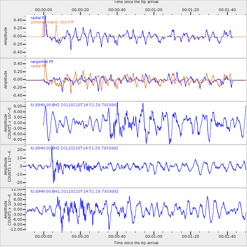
JOHN Johnston Island, USA - Earthquake Result Viewer
*The percent match for this event was below the threshold and hence no stack was calculated.
| Earthquake location: |
Celebes Sea |
| Earthquake latitude/longitude: |
4.1/123.0 |
| Earthquake time(UTC): |
2011/02/10 (041) 14:41:58 GMT |
| Earthquake Depth: |
525 km |
| Earthquake Magnitude: |
6.3 MB, 6.6 MW, 6.5 MW |
| Earthquake Catalog/Contributor: |
WHDF/NEIC |
|
| Network: |
IU Global Seismograph Network (GSN - IRIS/USGS) |
| Station: |
JOHN Johnston Island, USA |
| Lat/Lon: |
16.73 N/169.53 W |
| Elevation: |
2.0 m |
|
| Distance: |
67.2 deg |
| Az: |
73.657 deg |
| Baz: |
267.397 deg |
| Ray Param: |
$rayparam |
*The percent match for this event was below the threshold and hence was not used in the summary stack. |
|
| Radial Match: |
41.102367 % |
| Radial Bump: |
387 |
| Transverse Match: |
45.42742 % |
| Transverse Bump: |
319 |
| SOD ConfigId: |
617450 |
| Insert Time: |
2013-10-01 18:24:57.754 +0000 |
| GWidth: |
2.5 |
| Max Bumps: |
400 |
| Tol: |
0.001 |
|
Signal To Noise
| Channel | StoN | STA | LTA |
| IU:JOHN:00:BHZ:20110210T14:51:29.793999Z | 3.4677653 | 6.272174E-6 | 1.8087077E-6 |
| IU:JOHN:00:BH1:20110210T14:51:29.793999Z | 0.6093606 | 1.7079685E-6 | 2.8028865E-6 |
| IU:JOHN:00:BH2:20110210T14:51:29.793999Z | 0.82618546 | 2.8122358E-6 | 3.4038794E-6 |
| Arrivals |
| Ps | |
| PpPs | |
| PsPs/PpSs | |


