You are here: Home > Network List > IU - Global Seismograph Network (GSN - IRIS/USGS) Stations List
> Station POHA Pohakuloa, Hawaii, USA > Earthquake Result Viewer
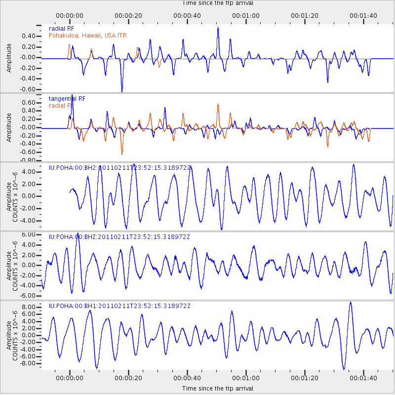
POHA Pohakuloa, Hawaii, USA - Earthquake Result Viewer
*The percent match for this event was below the threshold and hence no stack was calculated.
| Earthquake location: |
Near Coast Of Central Chile |
| Earthquake latitude/longitude: |
-37.2/-73.2 |
| Earthquake time(UTC): |
2011/02/11 (042) 23:39:21 GMT |
| Earthquake Depth: |
15 km |
| Earthquake Magnitude: |
5.5 MB, 5.7 MS, 6.0 MW, 5.9 MW |
| Earthquake Catalog/Contributor: |
WHDF/NEIC |
|
| Network: |
IU Global Seismograph Network (GSN - IRIS/USGS) |
| Station: |
POHA Pohakuloa, Hawaii, USA |
| Lat/Lon: |
19.76 N/155.53 W |
| Elevation: |
1990 m |
|
| Distance: |
95.9 deg |
| Az: |
290.228 deg |
| Baz: |
127.294 deg |
| Ray Param: |
$rayparam |
*The percent match for this event was below the threshold and hence was not used in the summary stack. |
|
| Radial Match: |
51.44115 % |
| Radial Bump: |
294 |
| Transverse Match: |
63.939495 % |
| Transverse Bump: |
237 |
| SOD ConfigId: |
617450 |
| Insert Time: |
2013-10-01 18:29:11.766 +0000 |
| GWidth: |
2.5 |
| Max Bumps: |
400 |
| Tol: |
0.001 |
|
Signal To Noise
| Channel | StoN | STA | LTA |
| IU:POHA:00:BHZ:20110211T23:52:15.318972Z | 1.9695654 | 3.934504E-6 | 1.997651E-6 |
| IU:POHA:00:BH1:20110211T23:52:15.318972Z | 1.9401081 | 4.3700193E-6 | 2.2524619E-6 |
| IU:POHA:00:BH2:20110211T23:52:15.318972Z | 0.7729384 | 2.1517428E-6 | 2.7838478E-6 |
| Arrivals |
| Ps | |
| PpPs | |
| PsPs/PpSs | |


