You are here: Home > Network List > IU - Global Seismograph Network (GSN - IRIS/USGS) Stations List
> Station RSSD Black Hills, South Dakota, USA > Earthquake Result Viewer
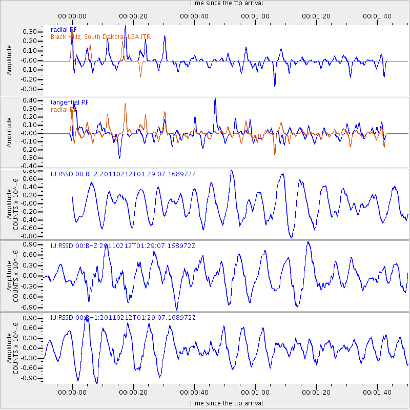
RSSD Black Hills, South Dakota, USA - Earthquake Result Viewer
*The percent match for this event was below the threshold and hence no stack was calculated.
| Earthquake location: |
Central Chile |
| Earthquake latitude/longitude: |
-37.0/-73.0 |
| Earthquake time(UTC): |
2011/02/12 (043) 01:17:01 GMT |
| Earthquake Depth: |
16 km |
| Earthquake Magnitude: |
5.8 MS, 5.4 MB, 6.1 MW, 6.1 MW |
| Earthquake Catalog/Contributor: |
WHDF/NEIC |
|
| Network: |
IU Global Seismograph Network (GSN - IRIS/USGS) |
| Station: |
RSSD Black Hills, South Dakota, USA |
| Lat/Lon: |
44.12 N/104.04 W |
| Elevation: |
2090 m |
|
| Distance: |
85.5 deg |
| Az: |
338.103 deg |
| Baz: |
155.518 deg |
| Ray Param: |
$rayparam |
*The percent match for this event was below the threshold and hence was not used in the summary stack. |
|
| Radial Match: |
47.93986 % |
| Radial Bump: |
399 |
| Transverse Match: |
49.422916 % |
| Transverse Bump: |
348 |
| SOD ConfigId: |
617450 |
| Insert Time: |
2013-10-01 18:30:53.554 +0000 |
| GWidth: |
2.5 |
| Max Bumps: |
400 |
| Tol: |
0.001 |
|
Signal To Noise
| Channel | StoN | STA | LTA |
| IU:RSSD:00:BHZ:20110212T01:29:07.168972Z | 0.53401387 | 1.6097773E-7 | 3.014486E-7 |
| IU:RSSD:00:BH1:20110212T01:29:07.168972Z | 1.926764 | 6.2099247E-7 | 3.2229815E-7 |
| IU:RSSD:00:BH2:20110212T01:29:07.168972Z | 0.4508109 | 1.3333712E-7 | 2.957717E-7 |
| Arrivals |
| Ps | |
| PpPs | |
| PsPs/PpSs | |


