You are here: Home > Network List > IU - Global Seismograph Network (GSN - IRIS/USGS) Stations List
> Station MAKZ Makanchi, Kazakhstan > Earthquake Result Viewer
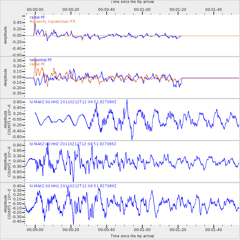
MAKZ Makanchi, Kazakhstan - Earthquake Result Viewer
*The percent match for this event was below the threshold and hence no stack was calculated.
| Earthquake location: |
Northern Molucca Sea |
| Earthquake latitude/longitude: |
2.0/126.8 |
| Earthquake time(UTC): |
2011/02/12 (043) 11:55:24 GMT |
| Earthquake Depth: |
35 km |
| Earthquake Magnitude: |
5.8 MW, 5.6 MW, 5.7 MB |
| Earthquake Catalog/Contributor: |
NEIC PDE/NEIC PDE-M |
|
| Network: |
IU Global Seismograph Network (GSN - IRIS/USGS) |
| Station: |
MAKZ Makanchi, Kazakhstan |
| Lat/Lon: |
46.81 N/81.98 E |
| Elevation: |
600 m |
|
| Distance: |
59.2 deg |
| Az: |
325.673 deg |
| Baz: |
124.867 deg |
| Ray Param: |
$rayparam |
*The percent match for this event was below the threshold and hence was not used in the summary stack. |
|
| Radial Match: |
75.83558 % |
| Radial Bump: |
400 |
| Transverse Match: |
75.08295 % |
| Transverse Bump: |
400 |
| SOD ConfigId: |
617450 |
| Insert Time: |
2013-10-01 18:35:16.445 +0000 |
| GWidth: |
2.5 |
| Max Bumps: |
400 |
| Tol: |
0.001 |
|
Signal To Noise
| Channel | StoN | STA | LTA |
| IU:MAKZ:00:HHZ:20110212T12:04:51.827986Z | 1.4526606 | 2.532105E-7 | 1.7430808E-7 |
| IU:MAKZ:00:HH1:20110212T12:04:51.827986Z | 1.288902 | 1.5743595E-7 | 1.2214734E-7 |
| IU:MAKZ:00:HH2:20110212T12:04:51.827986Z | 2.3836896 | 2.4286766E-7 | 1.0188728E-7 |
| Arrivals |
| Ps | |
| PpPs | |
| PsPs/PpSs | |


