You are here: Home > Network List > IU - Global Seismograph Network (GSN - IRIS/USGS) Stations List
> Station POHA Pohakuloa, Hawaii, USA > Earthquake Result Viewer
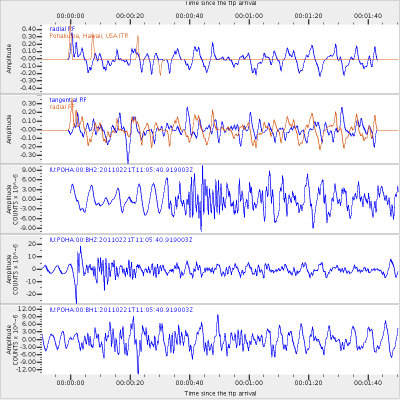
POHA Pohakuloa, Hawaii, USA - Earthquake Result Viewer
*The percent match for this event was below the threshold and hence no stack was calculated.
| Earthquake location: |
South Of Fiji Islands |
| Earthquake latitude/longitude: |
-26.1/178.4 |
| Earthquake time(UTC): |
2011/02/21 (052) 10:57:52 GMT |
| Earthquake Depth: |
558 km |
| Earthquake Magnitude: |
6.5 MW, 6.3 MB, 6.6 MW |
| Earthquake Catalog/Contributor: |
NEIC PDE/NEIC PDE-M |
|
| Network: |
IU Global Seismograph Network (GSN - IRIS/USGS) |
| Station: |
POHA Pohakuloa, Hawaii, USA |
| Lat/Lon: |
19.76 N/155.53 W |
| Elevation: |
1990 m |
|
| Distance: |
52.2 deg |
| Az: |
31.604 deg |
| Baz: |
210.009 deg |
| Ray Param: |
$rayparam |
*The percent match for this event was below the threshold and hence was not used in the summary stack. |
|
| Radial Match: |
56.274815 % |
| Radial Bump: |
400 |
| Transverse Match: |
61.469135 % |
| Transverse Bump: |
400 |
| SOD ConfigId: |
617450 |
| Insert Time: |
2013-10-01 19:03:19.190 +0000 |
| GWidth: |
2.5 |
| Max Bumps: |
400 |
| Tol: |
0.001 |
|
Signal To Noise
| Channel | StoN | STA | LTA |
| IU:POHA:00:BHZ:20110221T11:05:40.919003Z | 5.060891 | 9.804287E-6 | 1.937265E-6 |
| IU:POHA:00:BH1:20110221T11:05:40.919003Z | 0.66997707 | 1.8518151E-6 | 2.7639976E-6 |
| IU:POHA:00:BH2:20110221T11:05:40.919003Z | 1.6563233 | 3.7557024E-6 | 2.2674938E-6 |
| Arrivals |
| Ps | |
| PpPs | |
| PsPs/PpSs | |


