You are here: Home > Network List > IU - Global Seismograph Network (GSN - IRIS/USGS) Stations List
> Station JOHN Johnston Island, USA > Earthquake Result Viewer
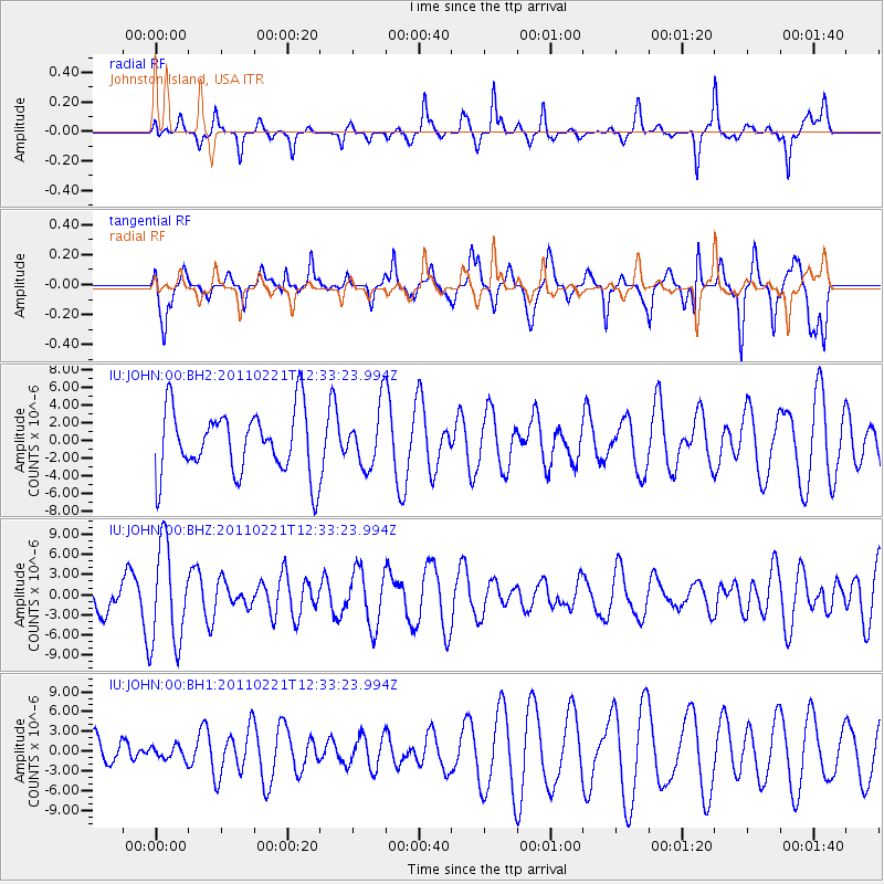
JOHN Johnston Island, USA - Earthquake Result Viewer
*The percent match for this event was below the threshold and hence no stack was calculated.
| Earthquake location: |
Solomon Islands |
| Earthquake latitude/longitude: |
-10.3/161.4 |
| Earthquake time(UTC): |
2011/02/21 (052) 12:26:32 GMT |
| Earthquake Depth: |
70 km |
| Earthquake Magnitude: |
5.5 MW |
| Earthquake Catalog/Contributor: |
NEIC PDE/NEIC PDE-M |
|
| Network: |
IU Global Seismograph Network (GSN - IRIS/USGS) |
| Station: |
JOHN Johnston Island, USA |
| Lat/Lon: |
16.73 N/169.53 W |
| Elevation: |
2.0 m |
|
| Distance: |
39.3 deg |
| Az: |
47.253 deg |
| Baz: |
228.96 deg |
| Ray Param: |
$rayparam |
*The percent match for this event was below the threshold and hence was not used in the summary stack. |
|
| Radial Match: |
47.881783 % |
| Radial Bump: |
231 |
| Transverse Match: |
61.358147 % |
| Transverse Bump: |
309 |
| SOD ConfigId: |
617450 |
| Insert Time: |
2013-10-01 19:07:17.266 +0000 |
| GWidth: |
2.5 |
| Max Bumps: |
400 |
| Tol: |
0.001 |
|
Signal To Noise
| Channel | StoN | STA | LTA |
| IU:JOHN:00:BHZ:20110221T12:33:23.994Z | 2.8872879 | 7.3518654E-6 | 2.5462875E-6 |
| IU:JOHN:00:BH1:20110221T12:33:23.994Z | 0.22988237 | 1.0035845E-6 | 4.3656432E-6 |
| IU:JOHN:00:BH2:20110221T12:33:23.994Z | 0.9235198 | 3.349871E-6 | 3.6272863E-6 |
| Arrivals |
| Ps | |
| PpPs | |
| PsPs/PpSs | |


