You are here: Home > Network List > IU - Global Seismograph Network (GSN - IRIS/USGS) Stations List
> Station MAKZ Makanchi, Kazakhstan > Earthquake Result Viewer
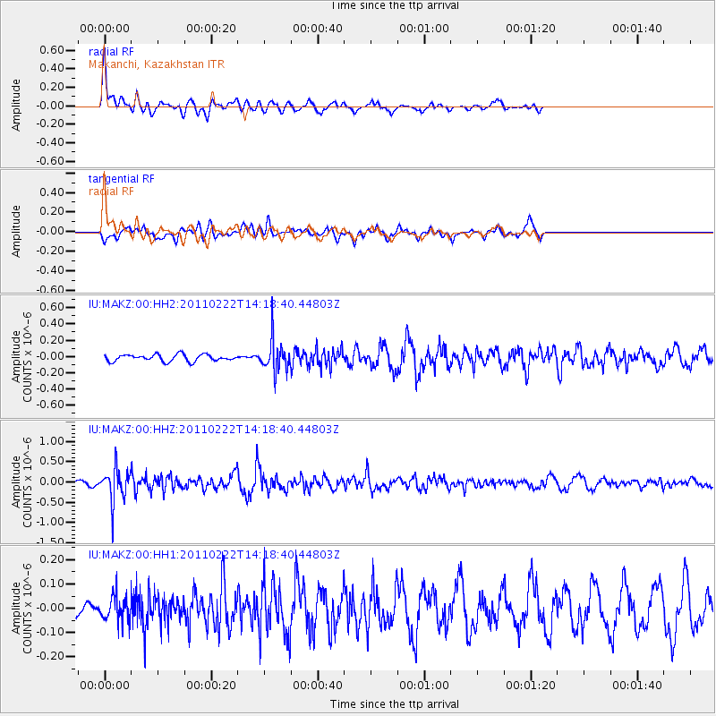
MAKZ Makanchi, Kazakhstan - Earthquake Result Viewer
*The percent match for this event was below the threshold and hence no stack was calculated.
| Earthquake location: |
Volcano Islands, Japan Region |
| Earthquake latitude/longitude: |
22.1/143.8 |
| Earthquake time(UTC): |
2011/02/22 (053) 14:09:50 GMT |
| Earthquake Depth: |
113 km |
| Earthquake Magnitude: |
5.5 MW, 5.5 MW, 5.6 MB |
| Earthquake Catalog/Contributor: |
NEIC PDE/NEIC PDE-M |
|
| Network: |
IU Global Seismograph Network (GSN - IRIS/USGS) |
| Station: |
MAKZ Makanchi, Kazakhstan |
| Lat/Lon: |
46.81 N/81.98 E |
| Elevation: |
600 m |
|
| Distance: |
55.1 deg |
| Az: |
312.382 deg |
| Baz: |
94.249 deg |
| Ray Param: |
$rayparam |
*The percent match for this event was below the threshold and hence was not used in the summary stack. |
|
| Radial Match: |
72.038994 % |
| Radial Bump: |
380 |
| Transverse Match: |
60.200268 % |
| Transverse Bump: |
400 |
| SOD ConfigId: |
617450 |
| Insert Time: |
2013-10-01 19:14:00.491 +0000 |
| GWidth: |
2.5 |
| Max Bumps: |
400 |
| Tol: |
0.001 |
|
Signal To Noise
| Channel | StoN | STA | LTA |
| IU:MAKZ:00:HHZ:20110222T14:18:40.44803Z | 7.7354097 | 4.0994914E-7 | 5.2996434E-8 |
| IU:MAKZ:00:HH1:20110222T14:18:40.44803Z | 1.9012393 | 5.0248122E-8 | 2.6429142E-8 |
| IU:MAKZ:00:HH2:20110222T14:18:40.44803Z | 4.5705357 | 1.8923778E-7 | 4.1403855E-8 |
| Arrivals |
| Ps | |
| PpPs | |
| PsPs/PpSs | |


