You are here: Home > Network List > II - Global Seismograph Network (GSN - IRIS/IDA) Stations List
> Station WRAB Tennant Creek, NT, Australia > Earthquake Result Viewer
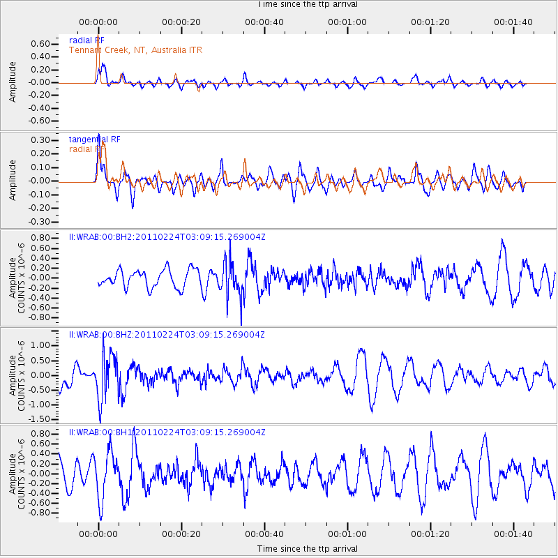
WRAB Tennant Creek, NT, Australia - Earthquake Result Viewer
*The percent match for this event was below the threshold and hence no stack was calculated.
| Earthquake location: |
Tonga Islands |
| Earthquake latitude/longitude: |
-17.8/-174.4 |
| Earthquake time(UTC): |
2011/02/24 (055) 03:01:16 GMT |
| Earthquake Depth: |
122 km |
| Earthquake Magnitude: |
5.6 MW |
| Earthquake Catalog/Contributor: |
NEIC PDE/NEIC PDE-M |
|
| Network: |
II Global Seismograph Network (GSN - IRIS/IDA) |
| Station: |
WRAB Tennant Creek, NT, Australia |
| Lat/Lon: |
19.93 S/134.36 E |
| Elevation: |
366 m |
|
| Distance: |
48.3 deg |
| Az: |
258.915 deg |
| Baz: |
96.435 deg |
| Ray Param: |
$rayparam |
*The percent match for this event was below the threshold and hence was not used in the summary stack. |
|
| Radial Match: |
77.72925 % |
| Radial Bump: |
400 |
| Transverse Match: |
51.618263 % |
| Transverse Bump: |
400 |
| SOD ConfigId: |
617450 |
| Insert Time: |
2013-10-01 19:17:44.292 +0000 |
| GWidth: |
2.5 |
| Max Bumps: |
400 |
| Tol: |
0.001 |
|
Signal To Noise
| Channel | StoN | STA | LTA |
| II:WRAB:00:BHZ:20110224T03:09:15.269004Z | 1.9491814 | 7.7992695E-7 | 4.001305E-7 |
| II:WRAB:00:BH1:20110224T03:09:15.269004Z | 1.9786544 | 4.7899164E-7 | 2.420795E-7 |
| II:WRAB:00:BH2:20110224T03:09:15.269004Z | 2.0825222 | 3.650559E-7 | 1.752951E-7 |
| Arrivals |
| Ps | |
| PpPs | |
| PsPs/PpSs | |


