You are here: Home > Network List > CU - Caribbean Network (USGS) Stations List
> Station BBGH Gun Hill, Barbados > Earthquake Result Viewer
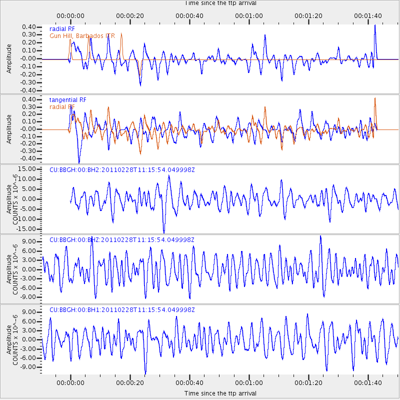
BBGH Gun Hill, Barbados - Earthquake Result Viewer
*The percent match for this event was below the threshold and hence no stack was calculated.
| Earthquake location: |
East Of South Sandwich Islands |
| Earthquake latitude/longitude: |
-59.2/-17.0 |
| Earthquake time(UTC): |
2011/02/28 (059) 11:04:16 GMT |
| Earthquake Depth: |
10 km |
| Earthquake Magnitude: |
5.6 MW |
| Earthquake Catalog/Contributor: |
NEIC PDE/NEIC PDE-M |
|
| Network: |
CU Caribbean Network (USGS) |
| Station: |
BBGH Gun Hill, Barbados |
| Lat/Lon: |
13.14 N/59.56 W |
| Elevation: |
180 m |
|
| Distance: |
79.9 deg |
| Az: |
318.006 deg |
| Baz: |
159.324 deg |
| Ray Param: |
$rayparam |
*The percent match for this event was below the threshold and hence was not used in the summary stack. |
|
| Radial Match: |
55.73305 % |
| Radial Bump: |
400 |
| Transverse Match: |
63.33483 % |
| Transverse Bump: |
400 |
| SOD ConfigId: |
617450 |
| Insert Time: |
2013-10-01 19:26:06.143 +0000 |
| GWidth: |
2.5 |
| Max Bumps: |
400 |
| Tol: |
0.001 |
|
Signal To Noise
| Channel | StoN | STA | LTA |
| CU:BBGH:00:BHZ:20110228T11:15:54.049998Z | 0.6151713 | 2.598153E-6 | 4.2234624E-6 |
| CU:BBGH:00:BH1:20110228T11:15:54.049998Z | 0.89455867 | 3.5229034E-6 | 3.938147E-6 |
| CU:BBGH:00:BH2:20110228T11:15:54.049998Z | 2.0498857 | 7.79206E-6 | 3.801217E-6 |
| Arrivals |
| Ps | |
| PpPs | |
| PsPs/PpSs | |


