KONO Kongsberg, Norway - Earthquake Result Viewer
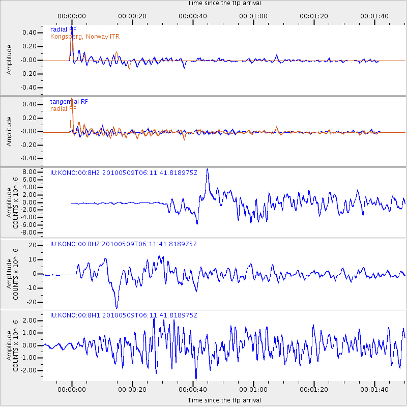
Earthquake location: Northern Sumatra, Indonesia
Earthquake latitude/longitude: 3.7/96.0
Earthquake time(UTC): 2010/05/09 (129) 05:59:41 GMT
Earthquake Depth: 38 km
Earthquake Magnitude: 7.2 MW, 6.6 MB, 7.2 MW, 7.3 MS
Earthquake Catalog/Contributor: NEIC PDE/NEIC PDE-M
Network: IU Global Seismograph Network (GSN - IRIS/USGS)
Station: KONO Kongsberg, Norway
Lat/Lon: 59.65 N/9.60 E
Elevation: 216 m
Distance: 85.0 deg
Az: 329.417 deg
Baz: 91.191 deg
Ray Param: 0.04504154
Estimated Moho Depth: 33.25 km
Estimated Crust Vp/Vs: 1.80
Assumed Crust Vp: 6.545 km/s
Estimated Crust Vs: 3.636 km/s
Estimated Crust Poisson's Ratio: 0.28
Radial Match: 98.214386 %
Radial Bump: 400
Transverse Match: 90.36257 %
Transverse Bump: 400
SOD ConfigId: 626211
Insert Time: 2013-10-07 23:46:43.516 +0000
GWidth: 2.5
Max Bumps: 400
Tol: 0.001

Signal To Noise

ChannelStoNSTALTA
IU:KONO:00:BHZ:20100509T06:11:41.818975Z13.1104782.9634302E-62.2603525E-7
IU:KONO:00:BH1:20100509T06:11:41.818975Z2.6357992.6547744E-71.00719916E-7
IU:KONO:00:BH2:20100509T06:11:41.818975Z8.983821.207548E-61.3441365E-7
Arrivals
Ps4.2 SECOND
PpPs14 SECOND
PsPs/PpSs18 SECOND