
COR Corvallis, Oregon, USA - Earthquake Result Viewer
| ||||||||||||||||||
| ||||||||||||||||||
| ||||||||||||||||||
|
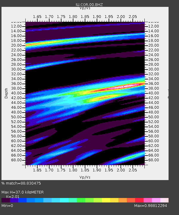
Signal To Noise
| Channel | StoN | STA | LTA |
| IU:COR:00:BHZ:20100718T13:16:41.769009Z | 12.137535 | 3.6796243E-6 | 3.0316076E-7 |
| IU:COR:00:BH1:20100718T13:16:41.769009Z | 1.2291418 | 3.1407617E-7 | 2.5552475E-7 |
| IU:COR:00:BH2:20100718T13:16:41.769009Z | 4.666352 | 1.0915694E-6 | 2.3392353E-7 |
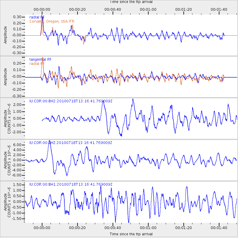
| Arrivals | |
| Ps | 5.8 SECOND |
| PpPs | 17 SECOND |
| PsPs/PpSs | 22 SECOND |

