You are here: Home > Network List > PF - Volcanologic Network of Piton de Fournaise-OVPF Stations List
> Station HIM cratere Himiltrude > Earthquake Result Viewer
HIM cratere Himiltrude - Earthquake Result Viewer
*The percent match for this event was below the threshold and hence no stack was calculated.
| Earthquake location: |
Bali Sea |
| Earthquake latitude/longitude: |
-7.0/117.6 |
| Earthquake time(UTC): |
2014/10/30 (303) 12:11:36 GMT |
| Earthquake Depth: |
546 km |
| Earthquake Magnitude: |
5.7 MB |
| Earthquake Catalog/Contributor: |
NEIC PDE/NEIC COMCAT |
|
| Network: |
PF Volcanologic Network of Piton de Fournaise-OVPF |
| Station: |
HIM cratere Himiltrude |
| Lat/Lon: |
21.21 S/55.72 E |
| Elevation: |
1958 m |
|
| Distance: |
61.3 deg |
| Az: |
249.724 deg |
| Baz: |
86.357 deg |
| Ray Param: |
$rayparam |
*The percent match for this event was below the threshold and hence was not used in the summary stack. |
|
| Radial Match: |
62.13447 % |
| Radial Bump: |
400 |
| Transverse Match: |
69.31054 % |
| Transverse Bump: |
400 |
| SOD ConfigId: |
3390531 |
| Insert Time: |
2019-04-14 19:08:02.612 +0000 |
| GWidth: |
2.5 |
| Max Bumps: |
400 |
| Tol: |
0.001 |
|
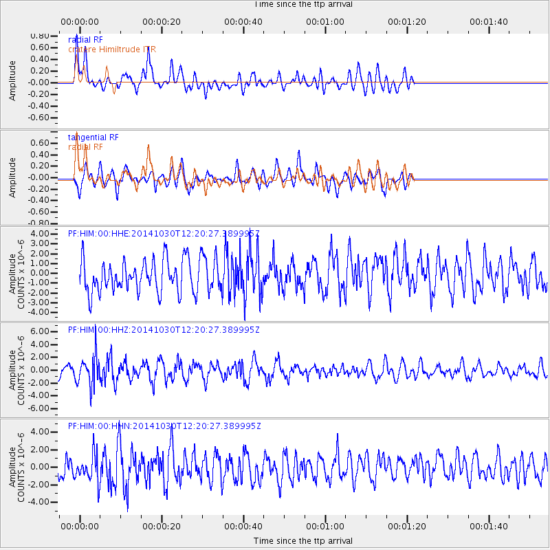
Signal To Noise
| Channel | StoN | STA | LTA |
| PF:HIM:00:HHZ:20141030T12:20:27.389995Z | 2.1918755 | 2.3431835E-6 | 1.0690313E-6 |
| PF:HIM:00:HHN:20141030T12:20:27.389995Z | 0.90735614 | 1.6401992E-6 | 1.8076686E-6 |
| PF:HIM:00:HHE:20141030T12:20:27.389995Z | 1.3024721 | 1.9930908E-6 | 1.5302367E-6 |
| Arrivals |
| Ps | |
| PpPs | |
| PsPs/PpSs | |


