You are here: Home > Network List > IU - Global Seismograph Network (GSN - IRIS/USGS) Stations List
> Station COR Corvallis, Oregon, USA > Earthquake Result Viewer
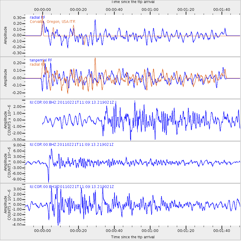
COR Corvallis, Oregon, USA - Earthquake Result Viewer
*The percent match for this event was below the threshold and hence no stack was calculated.
| Earthquake location: |
South Of Fiji Islands |
| Earthquake latitude/longitude: |
-26.1/178.4 |
| Earthquake time(UTC): |
2011/02/21 (052) 10:57:52 GMT |
| Earthquake Depth: |
558 km |
| Earthquake Magnitude: |
6.5 MW, 6.3 MB, 6.6 MW |
| Earthquake Catalog/Contributor: |
NEIC PDE/NEIC PDE-M |
|
| Network: |
IU Global Seismograph Network (GSN - IRIS/USGS) |
| Station: |
COR Corvallis, Oregon, USA |
| Lat/Lon: |
44.59 N/123.30 W |
| Elevation: |
110 m |
|
| Distance: |
88.2 deg |
| Az: |
37.463 deg |
| Baz: |
229.92 deg |
| Ray Param: |
$rayparam |
*The percent match for this event was below the threshold and hence was not used in the summary stack. |
|
| Radial Match: |
57.803356 % |
| Radial Bump: |
400 |
| Transverse Match: |
59.66998 % |
| Transverse Bump: |
400 |
| SOD ConfigId: |
626211 |
| Insert Time: |
2013-10-08 11:52:30.727 +0000 |
| GWidth: |
2.5 |
| Max Bumps: |
400 |
| Tol: |
0.001 |
|
Signal To Noise
| Channel | StoN | STA | LTA |
| IU:COR:00:BHZ:20110221T11:09:13.219021Z | 6.4871373 | 3.2741393E-6 | 5.047125E-7 |
| IU:COR:00:BH1:20110221T11:09:13.219021Z | 1.8037138 | 9.0746687E-7 | 5.0311024E-7 |
| IU:COR:00:BH2:20110221T11:09:13.219021Z | 1.349843 | 6.889271E-7 | 5.103757E-7 |
| Arrivals |
| Ps | |
| PpPs | |
| PsPs/PpSs | |


