You are here: Home > Network List > UU - University of Utah Regional Network Stations List
> Station CCUT Cedar City, UT, USA > Earthquake Result Viewer
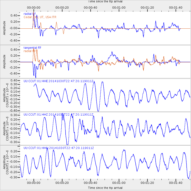
CCUT Cedar City, UT, USA - Earthquake Result Viewer
*The percent match for this event was below the threshold and hence no stack was calculated.
| Earthquake location: |
Near Coast Of Peru |
| Earthquake latitude/longitude: |
-16.2/-73.6 |
| Earthquake time(UTC): |
2014/10/30 (303) 22:37:15 GMT |
| Earthquake Depth: |
61 km |
| Earthquake Magnitude: |
5.1 MW |
| Earthquake Catalog/Contributor: |
ISC/ISC |
|
| Network: |
UU University of Utah Regional Network |
| Station: |
CCUT Cedar City, UT, USA |
| Lat/Lon: |
37.55 N/113.36 W |
| Elevation: |
2127 m |
|
| Distance: |
65.2 deg |
| Az: |
325.93 deg |
| Baz: |
137.361 deg |
| Ray Param: |
$rayparam |
*The percent match for this event was below the threshold and hence was not used in the summary stack. |
|
| Radial Match: |
51.201637 % |
| Radial Bump: |
400 |
| Transverse Match: |
73.617874 % |
| Transverse Bump: |
400 |
| SOD ConfigId: |
3390531 |
| Insert Time: |
2019-04-14 19:17:33.032 +0000 |
| GWidth: |
2.5 |
| Max Bumps: |
400 |
| Tol: |
0.001 |
|
Signal To Noise
| Channel | StoN | STA | LTA |
| UU:CCUT:01:HHZ:20141030T22:47:20.119011Z | 0.81124413 | 1.0848298E-7 | 1.3372421E-7 |
| UU:CCUT:01:HHN:20141030T22:47:20.119011Z | 0.6889107 | 8.593558E-8 | 1.2474125E-7 |
| UU:CCUT:01:HHE:20141030T22:47:20.119011Z | 1.3220232 | 1.624405E-7 | 1.2287266E-7 |
| Arrivals |
| Ps | |
| PpPs | |
| PsPs/PpSs | |


