You are here: Home > Network List > TA - USArray Transportable Network (new EarthScope stations) Stations List
> Station N50A Nevada, OH, USA > Earthquake Result Viewer
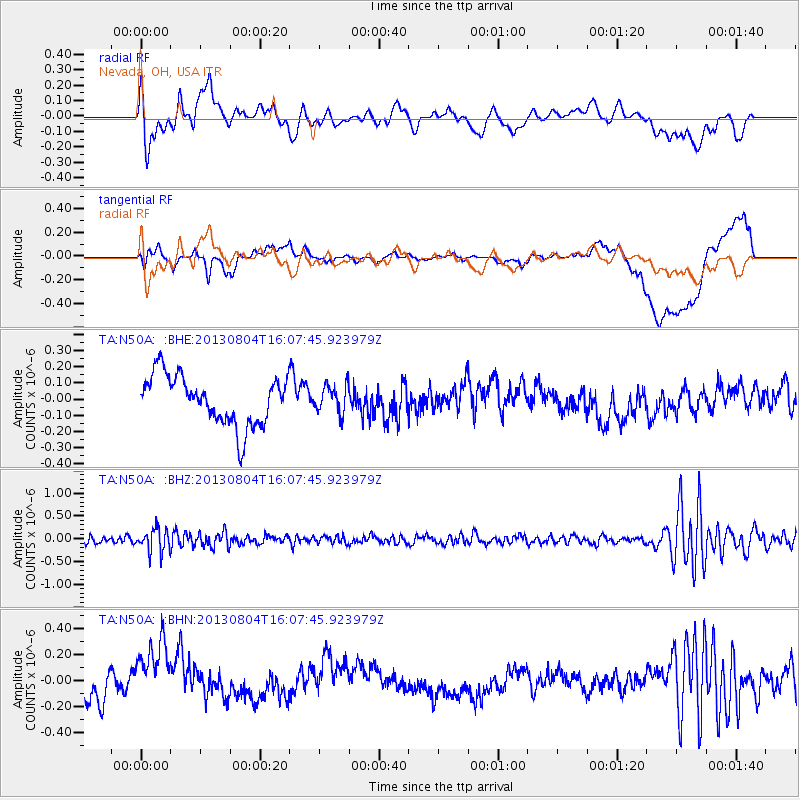
N50A Nevada, OH, USA - Earthquake Result Viewer
*The percent match for this event was below the threshold and hence no stack was calculated.
| Earthquake location: |
Sea Of Okhotsk |
| Earthquake latitude/longitude: |
47.0/145.2 |
| Earthquake time(UTC): |
2013/08/04 (216) 15:56:34 GMT |
| Earthquake Depth: |
375 km |
| Earthquake Magnitude: |
5.8 MW, 5.8 MW |
| Earthquake Catalog/Contributor: |
NEIC PDE/NEIC PDE-W |
|
| Network: |
TA USArray Transportable Network (new EarthScope stations) |
| Station: |
N50A Nevada, OH, USA |
| Lat/Lon: |
40.77 N/83.15 W |
| Elevation: |
277 m |
|
| Distance: |
82.6 deg |
| Az: |
34.919 deg |
| Baz: |
328.937 deg |
| Ray Param: |
$rayparam |
*The percent match for this event was below the threshold and hence was not used in the summary stack. |
|
| Radial Match: |
49.8869 % |
| Radial Bump: |
400 |
| Transverse Match: |
48.671185 % |
| Transverse Bump: |
400 |
| SOD ConfigId: |
626651 |
| Insert Time: |
2014-04-17 18:43:18.422 +0000 |
| GWidth: |
2.5 |
| Max Bumps: |
400 |
| Tol: |
0.001 |
|
Signal To Noise
| Channel | StoN | STA | LTA |
| TA:N50A: :BHZ:20130804T16:07:45.923979Z | 3.6055279 | 2.5373257E-7 | 7.0373204E-8 |
| TA:N50A: :BHN:20130804T16:07:45.923979Z | 1.659543 | 2.4239932E-7 | 1.460639E-7 |
| TA:N50A: :BHE:20130804T16:07:45.923979Z | 0.5603916 | 8.5431274E-8 | 1.5244925E-7 |
| Arrivals |
| Ps | |
| PpPs | |
| PsPs/PpSs | |


