You are here: Home > Network List > CN - Canadian National Seismograph Network Stations List
> Station INK INUVIK, NT > Earthquake Result Viewer
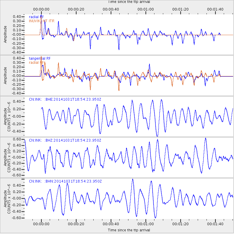
INK INUVIK, NT - Earthquake Result Viewer
*The percent match for this event was below the threshold and hence no stack was calculated.
| Earthquake location: |
Northern Peru |
| Earthquake latitude/longitude: |
-7.6/-76.4 |
| Earthquake time(UTC): |
2014/10/31 (304) 18:42:17 GMT |
| Earthquake Depth: |
10 km |
| Earthquake Magnitude: |
5.2 MW |
| Earthquake Catalog/Contributor: |
ISC/ISC |
|
| Network: |
CN Canadian National Seismograph Network |
| Station: |
INK INUVIK, NT |
| Lat/Lon: |
68.31 N/133.53 W |
| Elevation: |
44 m |
|
| Distance: |
85.6 deg |
| Az: |
341.749 deg |
| Baz: |
123.387 deg |
| Ray Param: |
$rayparam |
*The percent match for this event was below the threshold and hence was not used in the summary stack. |
|
| Radial Match: |
50.976665 % |
| Radial Bump: |
400 |
| Transverse Match: |
57.445522 % |
| Transverse Bump: |
400 |
| SOD ConfigId: |
3390531 |
| Insert Time: |
2019-04-14 19:22:17.553 +0000 |
| GWidth: |
2.5 |
| Max Bumps: |
400 |
| Tol: |
0.001 |
|
Signal To Noise
| Channel | StoN | STA | LTA |
| CN:INK: :BHZ:20141031T18:54:23.950Z | 0.902561 | 2.1659886E-7 | 2.399825E-7 |
| CN:INK: :BHN:20141031T18:54:23.950Z | 1.0100163 | 1.6441828E-7 | 1.6278774E-7 |
| CN:INK: :BHE:20141031T18:54:23.950Z | 1.8264304 | 2.743707E-7 | 1.5022236E-7 |
| Arrivals |
| Ps | |
| PpPs | |
| PsPs/PpSs | |


