You are here: Home > Network List > NI - North-East Italy Broadband Network Stations List
> Station CGRP Cima Grappa > Earthquake Result Viewer
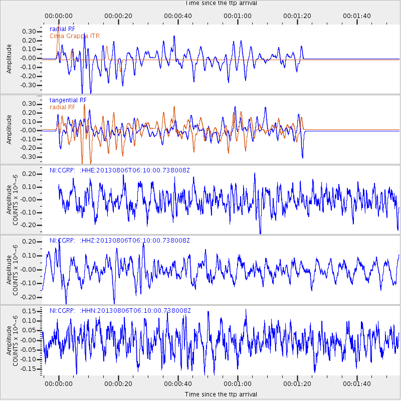
CGRP Cima Grappa - Earthquake Result Viewer
*The percent match for this event was below the threshold and hence no stack was calculated.
| Earthquake location: |
Guatemala |
| Earthquake latitude/longitude: |
14.2/-91.6 |
| Earthquake time(UTC): |
2013/08/06 (218) 05:57:42 GMT |
| Earthquake Depth: |
54 km |
| Earthquake Magnitude: |
5.5 MW, 5.5 MWC, 5.6 MWB |
| Earthquake Catalog/Contributor: |
NEIC PDE/NEIC COMCAT |
|
| Network: |
NI North-East Italy Broadband Network |
| Station: |
CGRP Cima Grappa |
| Lat/Lon: |
45.88 N/11.80 E |
| Elevation: |
1757 m |
|
| Distance: |
89.0 deg |
| Az: |
42.815 deg |
| Baz: |
289.307 deg |
| Ray Param: |
$rayparam |
*The percent match for this event was below the threshold and hence was not used in the summary stack. |
|
| Radial Match: |
50.147427 % |
| Radial Bump: |
400 |
| Transverse Match: |
46.214596 % |
| Transverse Bump: |
400 |
| SOD ConfigId: |
626651 |
| Insert Time: |
2014-04-17 19:10:24.570 +0000 |
| GWidth: |
2.5 |
| Max Bumps: |
400 |
| Tol: |
0.001 |
|
Signal To Noise
| Channel | StoN | STA | LTA |
| NI:CGRP: :HHZ:20130806T06:10:00.738008Z | 2.1630936 | 1.1289286E-7 | 5.2190465E-8 |
| NI:CGRP: :HHN:20130806T06:10:00.738008Z | 0.8937782 | 5.659819E-8 | 6.332464E-8 |
| NI:CGRP: :HHE:20130806T06:10:00.738008Z | 1.0668432 | 8.05625E-8 | 7.551485E-8 |
| Arrivals |
| Ps | |
| PpPs | |
| PsPs/PpSs | |


