You are here: Home > Network List > TA - USArray Transportable Network (new EarthScope stations) Stations List
> Station 121A Cookes Peak, Deming, NM, USA > Earthquake Result Viewer
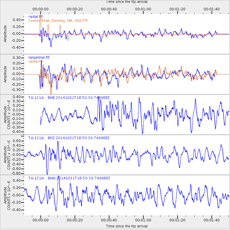
121A Cookes Peak, Deming, NM, USA - Earthquake Result Viewer
*The percent match for this event was below the threshold and hence no stack was calculated.
| Earthquake location: |
Northern Peru |
| Earthquake latitude/longitude: |
-7.6/-76.4 |
| Earthquake time(UTC): |
2014/10/31 (304) 18:42:17 GMT |
| Earthquake Depth: |
10 km |
| Earthquake Magnitude: |
5.2 MW |
| Earthquake Catalog/Contributor: |
ISC/ISC |
|
| Network: |
TA USArray Transportable Network (new EarthScope stations) |
| Station: |
121A Cookes Peak, Deming, NM, USA |
| Lat/Lon: |
32.53 N/107.79 W |
| Elevation: |
1652 m |
|
| Distance: |
49.9 deg |
| Az: |
324.894 deg |
| Baz: |
137.557 deg |
| Ray Param: |
$rayparam |
*The percent match for this event was below the threshold and hence was not used in the summary stack. |
|
| Radial Match: |
41.859737 % |
| Radial Bump: |
400 |
| Transverse Match: |
51.546555 % |
| Transverse Bump: |
400 |
| SOD ConfigId: |
3390531 |
| Insert Time: |
2019-04-14 19:25:36.895 +0000 |
| GWidth: |
2.5 |
| Max Bumps: |
400 |
| Tol: |
0.001 |
|
Signal To Noise
| Channel | StoN | STA | LTA |
| TA:121A: :BHZ:20141031T18:50:39.749988Z | 5.017669 | 3.337381E-7 | 6.651257E-8 |
| TA:121A: :BHN:20141031T18:50:39.749988Z | 1.7708 | 1.4725225E-7 | 8.3155776E-8 |
| TA:121A: :BHE:20141031T18:50:39.749988Z | 2.1979482 | 1.7990168E-7 | 8.184983E-8 |
| Arrivals |
| Ps | |
| PpPs | |
| PsPs/PpSs | |


