You are here: Home > Network List > TA - USArray Transportable Network (new EarthScope stations) Stations List
> Station L04D Klamath Falls, OR, USA > Earthquake Result Viewer
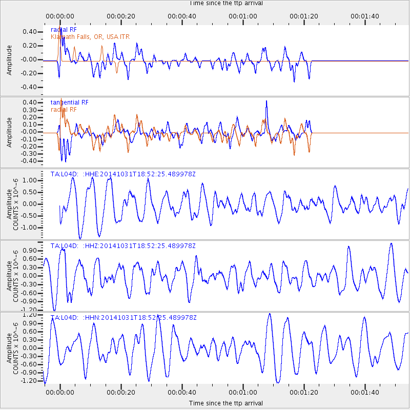
L04D Klamath Falls, OR, USA - Earthquake Result Viewer
*The percent match for this event was below the threshold and hence no stack was calculated.
| Earthquake location: |
Northern Peru |
| Earthquake latitude/longitude: |
-7.6/-76.4 |
| Earthquake time(UTC): |
2014/10/31 (304) 18:42:17 GMT |
| Earthquake Depth: |
10 km |
| Earthquake Magnitude: |
5.2 MW |
| Earthquake Catalog/Contributor: |
ISC/ISC |
|
| Network: |
TA USArray Transportable Network (new EarthScope stations) |
| Station: |
L04D Klamath Falls, OR, USA |
| Lat/Lon: |
42.22 N/122.30 W |
| Elevation: |
1437 m |
|
| Distance: |
64.9 deg |
| Az: |
323.912 deg |
| Baz: |
128.185 deg |
| Ray Param: |
$rayparam |
*The percent match for this event was below the threshold and hence was not used in the summary stack. |
|
| Radial Match: |
65.88824 % |
| Radial Bump: |
400 |
| Transverse Match: |
62.212017 % |
| Transverse Bump: |
400 |
| SOD ConfigId: |
3390531 |
| Insert Time: |
2019-04-14 19:25:56.684 +0000 |
| GWidth: |
2.5 |
| Max Bumps: |
400 |
| Tol: |
0.001 |
|
Signal To Noise
| Channel | StoN | STA | LTA |
| TA:L04D: :HHZ:20141031T18:52:25.489978Z | 2.0393171 | 6.960021E-7 | 3.4129172E-7 |
| TA:L04D: :HHN:20141031T18:52:25.489978Z | 0.6659659 | 3.2875892E-7 | 4.936573E-7 |
| TA:L04D: :HHE:20141031T18:52:25.489978Z | 0.68619347 | 5.067783E-7 | 7.3853556E-7 |
| Arrivals |
| Ps | |
| PpPs | |
| PsPs/PpSs | |


