You are here: Home > Network List > WY - Yellowstone Wyoming Seismic Network Stations List
> Station YPP Pitchstone Plateau, YNP, WY, USA > Earthquake Result Viewer
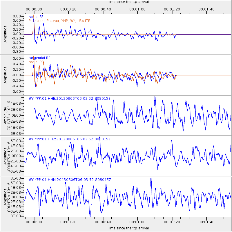
YPP Pitchstone Plateau, YNP, WY, USA - Earthquake Result Viewer
*The percent match for this event was below the threshold and hence no stack was calculated.
| Earthquake location: |
Guatemala |
| Earthquake latitude/longitude: |
14.2/-91.6 |
| Earthquake time(UTC): |
2013/08/06 (218) 05:57:42 GMT |
| Earthquake Depth: |
54 km |
| Earthquake Magnitude: |
5.5 MW, 5.5 MWC, 5.6 MWB |
| Earthquake Catalog/Contributor: |
NEIC PDE/NEIC COMCAT |
|
| Network: |
WY Yellowstone Wyoming Seismic Network |
| Station: |
YPP Pitchstone Plateau, YNP, WY, USA |
| Lat/Lon: |
44.27 N/110.80 W |
| Elevation: |
2707 m |
|
| Distance: |
34.2 deg |
| Az: |
335.134 deg |
| Baz: |
145.403 deg |
| Ray Param: |
$rayparam |
*The percent match for this event was below the threshold and hence was not used in the summary stack. |
|
| Radial Match: |
62.60558 % |
| Radial Bump: |
400 |
| Transverse Match: |
56.672726 % |
| Transverse Bump: |
400 |
| SOD ConfigId: |
626651 |
| Insert Time: |
2014-04-17 19:23:05.891 +0000 |
| GWidth: |
2.5 |
| Max Bumps: |
400 |
| Tol: |
0.001 |
|
Signal To Noise
| Channel | StoN | STA | LTA |
| WY:YPP:01:HHZ:20130806T06:03:52.808015Z | 1.4659265 | 2.0052595E-9 | 1.3679127E-9 |
| WY:YPP:01:HHN:20130806T06:03:52.808015Z | 1.7447402 | 3.3766396E-9 | 1.9353252E-9 |
| WY:YPP:01:HHE:20130806T06:03:52.808015Z | 1.3064775 | 1.6945009E-9 | 1.2969996E-9 |
| Arrivals |
| Ps | |
| PpPs | |
| PsPs/PpSs | |


