You are here: Home > Network List > US - United States National Seismic Network Stations List
> Station MSO Missoula, Montana, USA > Earthquake Result Viewer
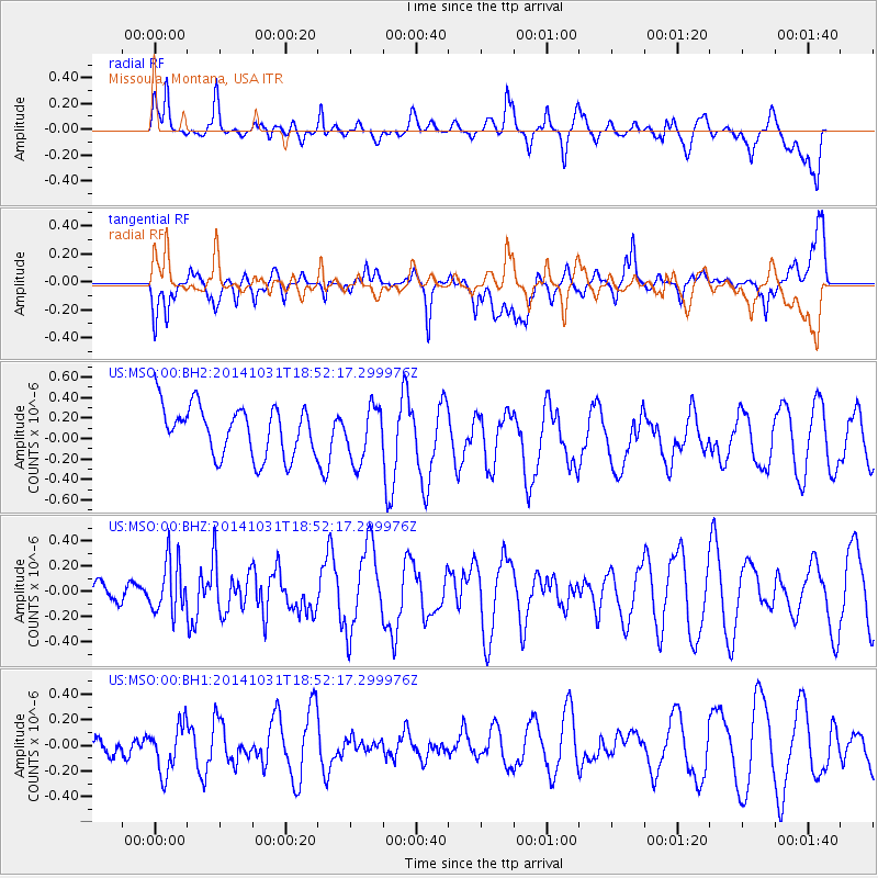
MSO Missoula, Montana, USA - Earthquake Result Viewer
*The percent match for this event was below the threshold and hence no stack was calculated.
| Earthquake location: |
Northern Peru |
| Earthquake latitude/longitude: |
-7.6/-76.4 |
| Earthquake time(UTC): |
2014/10/31 (304) 18:42:17 GMT |
| Earthquake Depth: |
10 km |
| Earthquake Magnitude: |
5.2 MW |
| Earthquake Catalog/Contributor: |
ISC/ISC |
|
| Network: |
US United States National Seismic Network |
| Station: |
MSO Missoula, Montana, USA |
| Lat/Lon: |
46.83 N/113.94 W |
| Elevation: |
1264 m |
|
| Distance: |
63.7 deg |
| Az: |
332.173 deg |
| Baz: |
137.63 deg |
| Ray Param: |
$rayparam |
*The percent match for this event was below the threshold and hence was not used in the summary stack. |
|
| Radial Match: |
62.0803 % |
| Radial Bump: |
400 |
| Transverse Match: |
62.310715 % |
| Transverse Bump: |
400 |
| SOD ConfigId: |
3390531 |
| Insert Time: |
2019-04-14 19:27:07.463 +0000 |
| GWidth: |
2.5 |
| Max Bumps: |
400 |
| Tol: |
0.001 |
|
Signal To Noise
| Channel | StoN | STA | LTA |
| US:MSO:00:BHZ:20141031T18:52:17.299976Z | 1.5527005 | 2.0785893E-7 | 1.338693E-7 |
| US:MSO:00:BH1:20141031T18:52:17.299976Z | 1.3678538 | 2.0174436E-7 | 1.4748971E-7 |
| US:MSO:00:BH2:20141031T18:52:17.299976Z | 1.1010318 | 2.6650258E-7 | 2.4204806E-7 |
| Arrivals |
| Ps | |
| PpPs | |
| PsPs/PpSs | |


