You are here: Home > Network List > AK - Alaska Regional Network Stations List
> Station MDM Murphy Dome > Earthquake Result Viewer
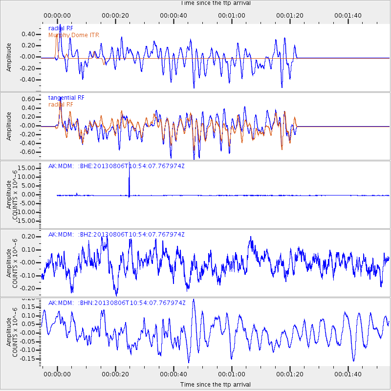
MDM Murphy Dome - Earthquake Result Viewer
*The percent match for this event was below the threshold and hence no stack was calculated.
| Earthquake location: |
Southeast Of Loyalty Islands |
| Earthquake latitude/longitude: |
-22.5/173.8 |
| Earthquake time(UTC): |
2013/08/06 (218) 10:41:30 GMT |
| Earthquake Depth: |
10 km |
| Earthquake Magnitude: |
5.8 MWW, 5.8 MWB, 5.9 MWC |
| Earthquake Catalog/Contributor: |
NEIC PDE/NEIC COMCAT |
|
| Network: |
AK Alaska Regional Network |
| Station: |
MDM Murphy Dome |
| Lat/Lon: |
64.96 N/148.23 W |
| Elevation: |
634 m |
|
| Distance: |
92.0 deg |
| Az: |
15.188 deg |
| Baz: |
214.697 deg |
| Ray Param: |
$rayparam |
*The percent match for this event was below the threshold and hence was not used in the summary stack. |
|
| Radial Match: |
47.021088 % |
| Radial Bump: |
400 |
| Transverse Match: |
40.18461 % |
| Transverse Bump: |
400 |
| SOD ConfigId: |
626651 |
| Insert Time: |
2014-04-17 19:25:51.866 +0000 |
| GWidth: |
2.5 |
| Max Bumps: |
400 |
| Tol: |
0.001 |
|
Signal To Noise
| Channel | StoN | STA | LTA |
| AK:MDM: :BHZ:20130806T10:54:07.767974Z | 1.3130711 | 8.0128785E-8 | 6.1023954E-8 |
| AK:MDM: :BHN:20130806T10:54:07.767974Z | 1.5594913 | 1.0436539E-7 | 6.6922716E-8 |
| AK:MDM: :BHE:20130806T10:54:07.767974Z | 0.13525803 | 1.3787978E-7 | 1.0193833E-6 |
| Arrivals |
| Ps | |
| PpPs | |
| PsPs/PpSs | |


