You are here: Home > Network List > AZ - ANZA Regional Network Stations List
> Station LVA2 AZ.LVA2 > Earthquake Result Viewer
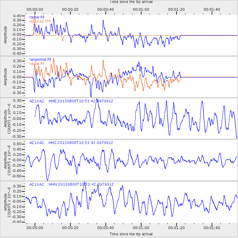
LVA2 AZ.LVA2 - Earthquake Result Viewer
*The percent match for this event was below the threshold and hence no stack was calculated.
| Earthquake location: |
Southeast Of Loyalty Islands |
| Earthquake latitude/longitude: |
-22.5/173.8 |
| Earthquake time(UTC): |
2013/08/06 (218) 10:41:30 GMT |
| Earthquake Depth: |
10 km |
| Earthquake Magnitude: |
5.8 MWW, 5.8 MWB, 5.9 MWC |
| Earthquake Catalog/Contributor: |
NEIC PDE/NEIC COMCAT |
|
| Network: |
AZ ANZA Regional Network |
| Station: |
LVA2 AZ.LVA2 |
| Lat/Lon: |
33.35 N/116.56 W |
| Elevation: |
1435 m |
|
| Distance: |
86.5 deg |
| Az: |
51.827 deg |
| Baz: |
240.293 deg |
| Ray Param: |
$rayparam |
*The percent match for this event was below the threshold and hence was not used in the summary stack. |
|
| Radial Match: |
55.919956 % |
| Radial Bump: |
400 |
| Transverse Match: |
47.967808 % |
| Transverse Bump: |
400 |
| SOD ConfigId: |
626651 |
| Insert Time: |
2014-04-17 19:28:49.707 +0000 |
| GWidth: |
2.5 |
| Max Bumps: |
400 |
| Tol: |
0.001 |
|
Signal To Noise
| Channel | StoN | STA | LTA |
| AZ:LVA2: :HHZ:20130806T10:53:42.097991Z | 2.3755815 | 1.8321785E-7 | 7.712548E-8 |
| AZ:LVA2: :HHN:20130806T10:53:42.097991Z | 1.1421857 | 8.8286534E-8 | 7.7296136E-8 |
| AZ:LVA2: :HHE:20130806T10:53:42.097991Z | 1.5627103 | 1.1857149E-7 | 7.587555E-8 |
| Arrivals |
| Ps | |
| PpPs | |
| PsPs/PpSs | |


