You are here: Home > Network List > AZ - ANZA Regional Network Stations List
> Station SMER AZ.SMER > Earthquake Result Viewer
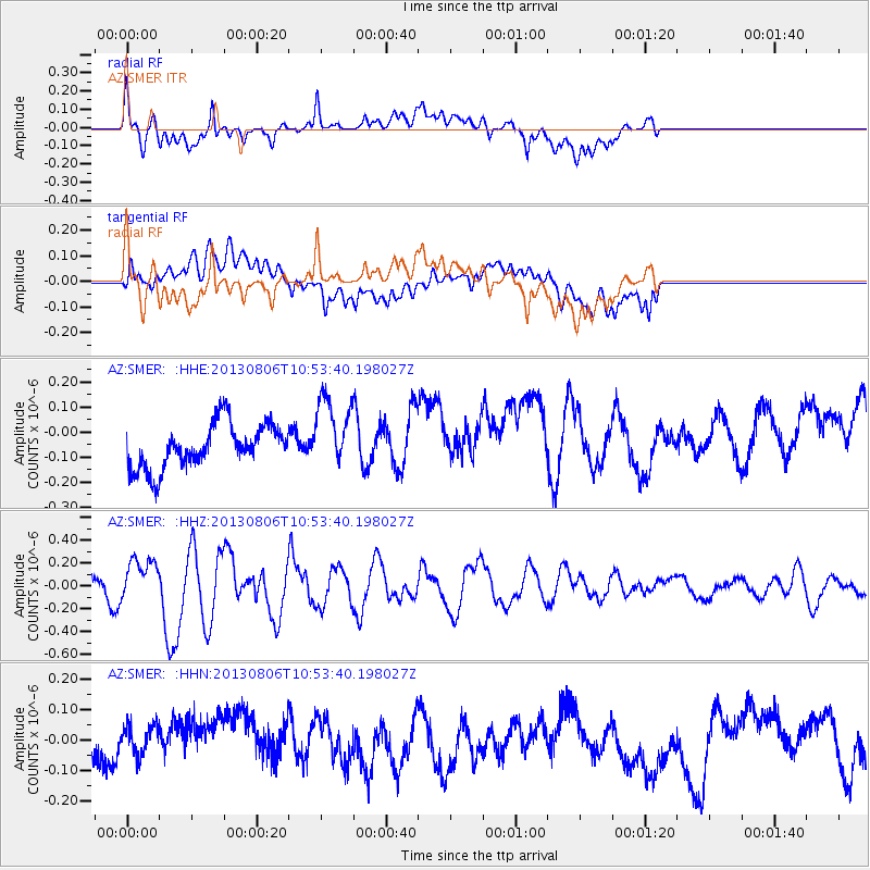
SMER AZ.SMER - Earthquake Result Viewer
*The percent match for this event was below the threshold and hence no stack was calculated.
| Earthquake location: |
Southeast Of Loyalty Islands |
| Earthquake latitude/longitude: |
-22.5/173.8 |
| Earthquake time(UTC): |
2013/08/06 (218) 10:41:30 GMT |
| Earthquake Depth: |
10 km |
| Earthquake Magnitude: |
5.8 MWW, 5.8 MWB, 5.9 MWC |
| Earthquake Catalog/Contributor: |
NEIC PDE/NEIC COMCAT |
|
| Network: |
AZ ANZA Regional Network |
| Station: |
SMER AZ.SMER |
| Lat/Lon: |
33.46 N/117.17 W |
| Elevation: |
355 m |
|
| Distance: |
86.1 deg |
| Az: |
51.481 deg |
| Baz: |
239.937 deg |
| Ray Param: |
$rayparam |
*The percent match for this event was below the threshold and hence was not used in the summary stack. |
|
| Radial Match: |
72.11557 % |
| Radial Bump: |
400 |
| Transverse Match: |
49.82035 % |
| Transverse Bump: |
400 |
| SOD ConfigId: |
626651 |
| Insert Time: |
2014-04-17 19:29:08.873 +0000 |
| GWidth: |
2.5 |
| Max Bumps: |
400 |
| Tol: |
0.001 |
|
Signal To Noise
| Channel | StoN | STA | LTA |
| AZ:SMER: :HHZ:20130806T10:53:40.198027Z | 1.5450011 | 1.6568683E-7 | 1.0724059E-7 |
| AZ:SMER: :HHN:20130806T10:53:40.198027Z | 0.6493652 | 5.5611935E-8 | 8.564046E-8 |
| AZ:SMER: :HHE:20130806T10:53:40.198027Z | 1.6487796 | 1.4513189E-7 | 8.8023825E-8 |
| Arrivals |
| Ps | |
| PpPs | |
| PsPs/PpSs | |


