You are here: Home > Network List > AZ - ANZA Regional Network Stations List
> Station SOL AZ.SOL > Earthquake Result Viewer
SOL AZ.SOL - Earthquake Result Viewer
*The percent match for this event was below the threshold and hence no stack was calculated.
| Earthquake location: |
Southeast Of Loyalty Islands |
| Earthquake latitude/longitude: |
-22.5/173.8 |
| Earthquake time(UTC): |
2013/08/06 (218) 10:41:30 GMT |
| Earthquake Depth: |
10 km |
| Earthquake Magnitude: |
5.8 MWW, 5.8 MWB, 5.9 MWC |
| Earthquake Catalog/Contributor: |
NEIC PDE/NEIC COMCAT |
|
| Network: |
AZ ANZA Regional Network |
| Station: |
SOL AZ.SOL |
| Lat/Lon: |
32.84 N/117.25 W |
| Elevation: |
245 m |
|
| Distance: |
85.7 deg |
| Az: |
51.982 deg |
| Baz: |
239.931 deg |
| Ray Param: |
$rayparam |
*The percent match for this event was below the threshold and hence was not used in the summary stack. |
|
| Radial Match: |
59.73544 % |
| Radial Bump: |
400 |
| Transverse Match: |
59.422325 % |
| Transverse Bump: |
400 |
| SOD ConfigId: |
626651 |
| Insert Time: |
2014-04-17 19:29:15.657 +0000 |
| GWidth: |
2.5 |
| Max Bumps: |
400 |
| Tol: |
0.001 |
|
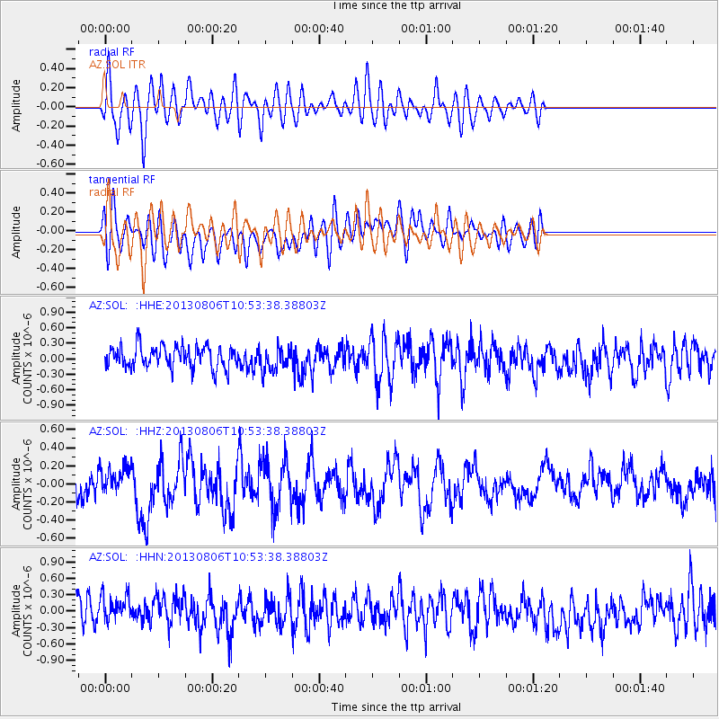
Signal To Noise
| Channel | StoN | STA | LTA |
| AZ:SOL: :HHZ:20130806T10:53:38.38803Z | 1.1111103 | 1.4329588E-7 | 1.2896638E-7 |
| AZ:SOL: :HHN:20130806T10:53:38.38803Z | 1.1451735 | 2.9388454E-7 | 2.5662882E-7 |
| AZ:SOL: :HHE:20130806T10:53:38.38803Z | 1.0649139 | 2.2516848E-7 | 2.1144291E-7 |
| Arrivals |
| Ps | |
| PpPs | |
| PsPs/PpSs | |


