You are here: Home > Network List > TA - USArray Transportable Network (new EarthScope stations) Stations List
> Station T25A Trinidad, CO, USA > Earthquake Result Viewer
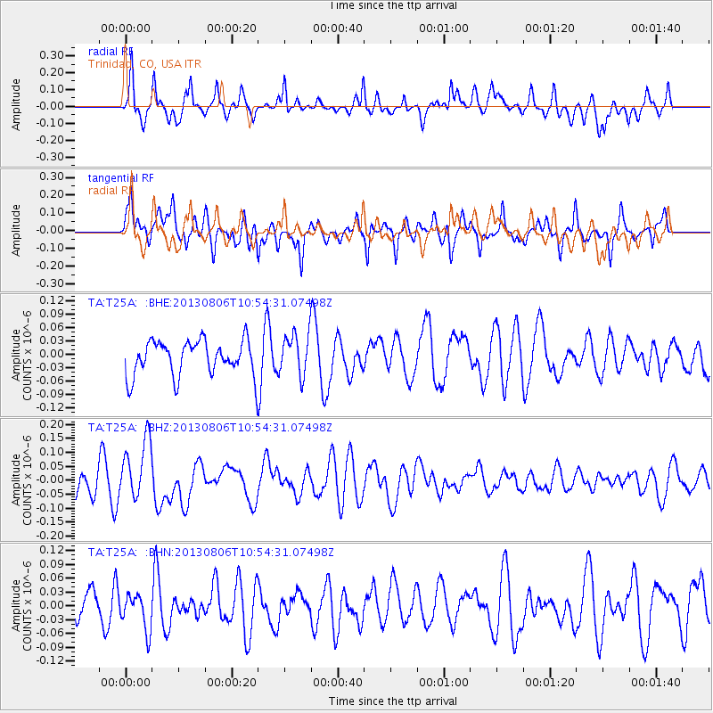
T25A Trinidad, CO, USA - Earthquake Result Viewer
*The percent match for this event was below the threshold and hence no stack was calculated.
| Earthquake location: |
Southeast Of Loyalty Islands |
| Earthquake latitude/longitude: |
-22.5/173.8 |
| Earthquake time(UTC): |
2013/08/06 (218) 10:41:30 GMT |
| Earthquake Depth: |
10 km |
| Earthquake Magnitude: |
5.8 MWW, 5.8 MWB, 5.9 MWC |
| Earthquake Catalog/Contributor: |
NEIC PDE/NEIC COMCAT |
|
| Network: |
TA USArray Transportable Network (new EarthScope stations) |
| Station: |
T25A Trinidad, CO, USA |
| Lat/Lon: |
37.14 N/104.41 W |
| Elevation: |
2017 m |
|
| Distance: |
97.1 deg |
| Az: |
52.843 deg |
| Baz: |
247.263 deg |
| Ray Param: |
$rayparam |
*The percent match for this event was below the threshold and hence was not used in the summary stack. |
|
| Radial Match: |
58.33889 % |
| Radial Bump: |
400 |
| Transverse Match: |
63.352825 % |
| Transverse Bump: |
400 |
| SOD ConfigId: |
626651 |
| Insert Time: |
2014-04-17 19:38:24.078 +0000 |
| GWidth: |
2.5 |
| Max Bumps: |
400 |
| Tol: |
0.001 |
|
Signal To Noise
| Channel | StoN | STA | LTA |
| TA:T25A: :BHZ:20130806T10:54:31.07498Z | 2.43257 | 1.0891631E-7 | 4.4774175E-8 |
| TA:T25A: :BHN:20130806T10:54:31.07498Z | 1.3137934 | 3.981135E-8 | 3.0302594E-8 |
| TA:T25A: :BHE:20130806T10:54:31.07498Z | 1.1899201 | 4.6746937E-8 | 3.928578E-8 |
| Arrivals |
| Ps | |
| PpPs | |
| PsPs/PpSs | |


