You are here: Home > Network List > UU - University of Utah Regional Network Stations List
> Station CCUT Cedar City, UT, USA > Earthquake Result Viewer
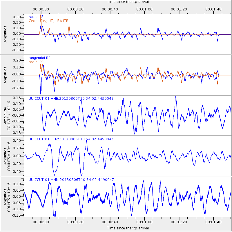
CCUT Cedar City, UT, USA - Earthquake Result Viewer
*The percent match for this event was below the threshold and hence no stack was calculated.
| Earthquake location: |
Southeast Of Loyalty Islands |
| Earthquake latitude/longitude: |
-22.5/173.8 |
| Earthquake time(UTC): |
2013/08/06 (218) 10:41:30 GMT |
| Earthquake Depth: |
10 km |
| Earthquake Magnitude: |
5.8 MWW, 5.8 MWB, 5.9 MWC |
| Earthquake Catalog/Contributor: |
NEIC PDE/NEIC COMCAT |
|
| Network: |
UU University of Utah Regional Network |
| Station: |
CCUT Cedar City, UT, USA |
| Lat/Lon: |
37.55 N/113.36 W |
| Elevation: |
2127 m |
|
| Distance: |
90.8 deg |
| Az: |
49.416 deg |
| Baz: |
242.085 deg |
| Ray Param: |
$rayparam |
*The percent match for this event was below the threshold and hence was not used in the summary stack. |
|
| Radial Match: |
63.441917 % |
| Radial Bump: |
400 |
| Transverse Match: |
65.9155 % |
| Transverse Bump: |
397 |
| SOD ConfigId: |
626651 |
| Insert Time: |
2014-04-17 19:39:46.987 +0000 |
| GWidth: |
2.5 |
| Max Bumps: |
400 |
| Tol: |
0.001 |
|
Signal To Noise
| Channel | StoN | STA | LTA |
| UU:CCUT:01:HHZ:20130806T10:54:02.449004Z | 2.6348088 | 1.4265868E-7 | 5.4143843E-8 |
| UU:CCUT:01:HHN:20130806T10:54:02.449004Z | 0.9251118 | 5.2799624E-8 | 5.7073777E-8 |
| UU:CCUT:01:HHE:20130806T10:54:02.449004Z | 0.7763735 | 4.2053188E-8 | 5.4166183E-8 |
| Arrivals |
| Ps | |
| PpPs | |
| PsPs/PpSs | |


