You are here: Home > Network List > X812 - Deep Structure of Three Continental Sutures in Eastern North America Stations List
> Station QM20 Hay Lake, Maine, USA > Earthquake Result Viewer
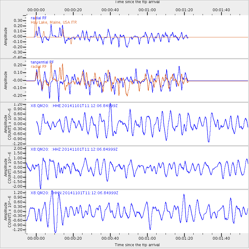
QM20 Hay Lake, Maine, USA - Earthquake Result Viewer
*The percent match for this event was below the threshold and hence no stack was calculated.
| Earthquake location: |
Easter Island Region |
| Earthquake latitude/longitude: |
-31.8/-111.2 |
| Earthquake time(UTC): |
2014/11/01 (305) 10:59:55 GMT |
| Earthquake Depth: |
10 km |
| Earthquake Magnitude: |
6.0 MWP |
| Earthquake Catalog/Contributor: |
NEIC PDE/NEIC COMCAT |
|
| Network: |
X8 Deep Structure of Three Continental Sutures in Eastern North America |
| Station: |
QM20 Hay Lake, Maine, USA |
| Lat/Lon: |
46.13 N/68.72 W |
| Elevation: |
207 m |
|
| Distance: |
86.6 deg |
| Az: |
28.056 deg |
| Baz: |
215.148 deg |
| Ray Param: |
$rayparam |
*The percent match for this event was below the threshold and hence was not used in the summary stack. |
|
| Radial Match: |
52.607033 % |
| Radial Bump: |
330 |
| Transverse Match: |
47.057247 % |
| Transverse Bump: |
341 |
| SOD ConfigId: |
3390531 |
| Insert Time: |
2019-04-14 19:45:16.266 +0000 |
| GWidth: |
2.5 |
| Max Bumps: |
400 |
| Tol: |
0.001 |
|
Signal To Noise
| Channel | StoN | STA | LTA |
| X8:QM20: :HHZ:20141101T11:12:06.84999Z | 2.277624 | 9.0113895E-7 | 3.956487E-7 |
| X8:QM20: :HHN:20141101T11:12:06.84999Z | 1.1041789 | 3.876325E-7 | 3.510595E-7 |
| X8:QM20: :HHE:20141101T11:12:06.84999Z | 1.6218691 | 4.3154753E-7 | 2.6608038E-7 |
| Arrivals |
| Ps | |
| PpPs | |
| PsPs/PpSs | |


