You are here: Home > Network List > TA - USArray Transportable Network (new EarthScope stations) Stations List
> Station L40A Anamosa, IA, USA > Earthquake Result Viewer
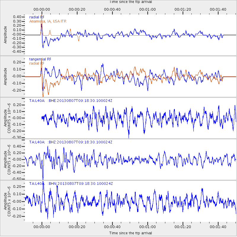
L40A Anamosa, IA, USA - Earthquake Result Viewer
*The percent match for this event was below the threshold and hence no stack was calculated.
| Earthquake location: |
Greece |
| Earthquake latitude/longitude: |
38.7/22.7 |
| Earthquake time(UTC): |
2013/08/07 (219) 09:06:52 GMT |
| Earthquake Depth: |
0.1 km |
| Earthquake Magnitude: |
5.5 MW, 5.3 MWR, 5.5 MWC |
| Earthquake Catalog/Contributor: |
NEIC PDE/NEIC COMCAT |
|
| Network: |
TA USArray Transportable Network (new EarthScope stations) |
| Station: |
L40A Anamosa, IA, USA |
| Lat/Lon: |
42.06 N/91.22 W |
| Elevation: |
242 m |
|
| Distance: |
79.7 deg |
| Az: |
316.218 deg |
| Baz: |
46.65 deg |
| Ray Param: |
$rayparam |
*The percent match for this event was below the threshold and hence was not used in the summary stack. |
|
| Radial Match: |
41.180485 % |
| Radial Bump: |
400 |
| Transverse Match: |
49.172382 % |
| Transverse Bump: |
400 |
| SOD ConfigId: |
626651 |
| Insert Time: |
2014-04-17 20:46:44.562 +0000 |
| GWidth: |
2.5 |
| Max Bumps: |
400 |
| Tol: |
0.001 |
|
Signal To Noise
| Channel | StoN | STA | LTA |
| TA:L40A: :BHZ:20130807T09:18:30.100024Z | 3.2112458 | 2.3933097E-7 | 7.4529005E-8 |
| TA:L40A: :BHN:20130807T09:18:30.100024Z | 1.2889222 | 1.4579471E-7 | 1.1311367E-7 |
| TA:L40A: :BHE:20130807T09:18:30.100024Z | 1.9810131 | 9.857817E-8 | 4.9761493E-8 |
| Arrivals |
| Ps | |
| PpPs | |
| PsPs/PpSs | |


