You are here: Home > Network List > TA - USArray Transportable Network (new EarthScope stations) Stations List
> Station U51A La Follette, TN, USA > Earthquake Result Viewer
U51A La Follette, TN, USA - Earthquake Result Viewer
*The percent match for this event was below the threshold and hence no stack was calculated.
| Earthquake location: |
Greece |
| Earthquake latitude/longitude: |
38.7/22.7 |
| Earthquake time(UTC): |
2013/08/07 (219) 09:06:52 GMT |
| Earthquake Depth: |
0.1 km |
| Earthquake Magnitude: |
5.5 MW, 5.3 MWR, 5.5 MWC |
| Earthquake Catalog/Contributor: |
NEIC PDE/NEIC COMCAT |
|
| Network: |
TA USArray Transportable Network (new EarthScope stations) |
| Station: |
U51A La Follette, TN, USA |
| Lat/Lon: |
36.38 N/84.02 W |
| Elevation: |
472 m |
|
| Distance: |
79.3 deg |
| Az: |
308.126 deg |
| Baz: |
49.717 deg |
| Ray Param: |
$rayparam |
*The percent match for this event was below the threshold and hence was not used in the summary stack. |
|
| Radial Match: |
67.60809 % |
| Radial Bump: |
400 |
| Transverse Match: |
51.92477 % |
| Transverse Bump: |
400 |
| SOD ConfigId: |
626651 |
| Insert Time: |
2014-04-17 20:54:03.622 +0000 |
| GWidth: |
2.5 |
| Max Bumps: |
400 |
| Tol: |
0.001 |
|
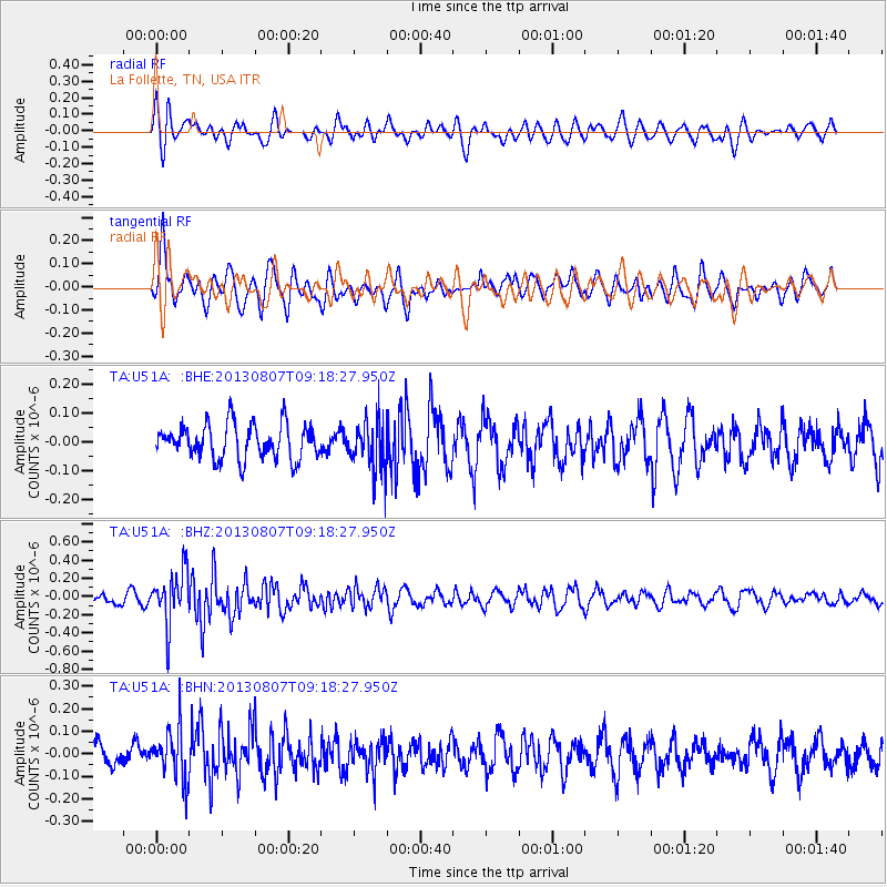
Signal To Noise
| Channel | StoN | STA | LTA |
| TA:U51A: :BHZ:20130807T09:18:27.950Z | 5.01023 | 2.8698508E-7 | 5.727982E-8 |
| TA:U51A: :BHN:20130807T09:18:27.950Z | 2.0855408 | 1.1429544E-7 | 5.4803742E-8 |
| TA:U51A: :BHE:20130807T09:18:27.950Z | 1.4123534 | 8.469827E-8 | 5.996961E-8 |
| Arrivals |
| Ps | |
| PpPs | |
| PsPs/PpSs | |


