You are here: Home > Network List > TA - USArray Transportable Network (new EarthScope stations) Stations List
> Station V53A Saluda, NC, USA > Earthquake Result Viewer
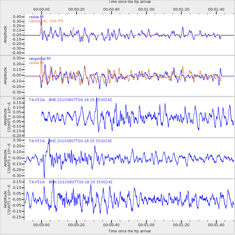
V53A Saluda, NC, USA - Earthquake Result Viewer
*The percent match for this event was below the threshold and hence no stack was calculated.
| Earthquake location: |
Greece |
| Earthquake latitude/longitude: |
38.7/22.7 |
| Earthquake time(UTC): |
2013/08/07 (219) 09:06:52 GMT |
| Earthquake Depth: |
0.1 km |
| Earthquake Magnitude: |
5.5 MW, 5.3 MWR, 5.5 MWC |
| Earthquake Catalog/Contributor: |
NEIC PDE/NEIC COMCAT |
|
| Network: |
TA USArray Transportable Network (new EarthScope stations) |
| Station: |
V53A Saluda, NC, USA |
| Lat/Lon: |
35.67 N/82.81 W |
| Elevation: |
681 m |
|
| Distance: |
79.0 deg |
| Az: |
306.935 deg |
| Baz: |
50.197 deg |
| Ray Param: |
$rayparam |
*The percent match for this event was below the threshold and hence was not used in the summary stack. |
|
| Radial Match: |
54.160976 % |
| Radial Bump: |
400 |
| Transverse Match: |
47.236626 % |
| Transverse Bump: |
400 |
| SOD ConfigId: |
626651 |
| Insert Time: |
2014-04-17 20:55:09.924 +0000 |
| GWidth: |
2.5 |
| Max Bumps: |
400 |
| Tol: |
0.001 |
|
Signal To Noise
| Channel | StoN | STA | LTA |
| TA:V53A: :BHZ:20130807T09:18:26.350024Z | 3.4303484 | 1.5405583E-7 | 4.4909672E-8 |
| TA:V53A: :BHN:20130807T09:18:26.350024Z | 0.915078 | 4.2871996E-8 | 4.6850644E-8 |
| TA:V53A: :BHE:20130807T09:18:26.350024Z | 2.1947112 | 8.875949E-8 | 4.0442448E-8 |
| Arrivals |
| Ps | |
| PpPs | |
| PsPs/PpSs | |


