You are here: Home > Network List > US - United States National Seismic Network Stations List
> Station HAWA Hanford, Washington, USA > Earthquake Result Viewer
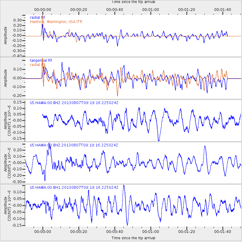
HAWA Hanford, Washington, USA - Earthquake Result Viewer
*The percent match for this event was below the threshold and hence no stack was calculated.
| Earthquake location: |
Greece |
| Earthquake latitude/longitude: |
38.7/22.7 |
| Earthquake time(UTC): |
2013/08/07 (219) 09:06:52 GMT |
| Earthquake Depth: |
0.1 km |
| Earthquake Magnitude: |
5.5 MW, 5.3 MWR, 5.5 MWC |
| Earthquake Catalog/Contributor: |
NEIC PDE/NEIC COMCAT |
|
| Network: |
US United States National Seismic Network |
| Station: |
HAWA Hanford, Washington, USA |
| Lat/Lon: |
46.39 N/119.53 W |
| Elevation: |
364 m |
|
| Distance: |
88.8 deg |
| Az: |
334.91 deg |
| Baz: |
28.651 deg |
| Ray Param: |
$rayparam |
*The percent match for this event was below the threshold and hence was not used in the summary stack. |
|
| Radial Match: |
45.89384 % |
| Radial Bump: |
400 |
| Transverse Match: |
62.564137 % |
| Transverse Bump: |
400 |
| SOD ConfigId: |
626651 |
| Insert Time: |
2014-04-17 20:59:51.651 +0000 |
| GWidth: |
2.5 |
| Max Bumps: |
400 |
| Tol: |
0.001 |
|
Signal To Noise
| Channel | StoN | STA | LTA |
| US:HAWA:00:BHZ:20130807T09:19:16.225024Z | 2.3670344 | 1.7760475E-7 | 7.50326E-8 |
| US:HAWA:00:BH1:20130807T09:19:16.225024Z | 0.77285576 | 3.464954E-8 | 4.4833122E-8 |
| US:HAWA:00:BH2:20130807T09:19:16.225024Z | 0.60391223 | 2.1234206E-8 | 3.516108E-8 |
| Arrivals |
| Ps | |
| PpPs | |
| PsPs/PpSs | |


