You are here: Home > Network List > US - United States National Seismic Network Stations List
> Station MSO Missoula, Montana, USA > Earthquake Result Viewer
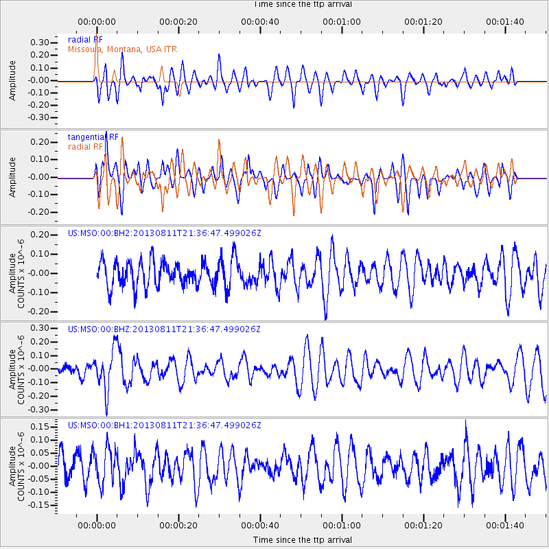
MSO Missoula, Montana, USA - Earthquake Result Viewer
*The percent match for this event was below the threshold and hence no stack was calculated.
| Earthquake location: |
Xizang |
| Earthquake latitude/longitude: |
30.0/98.0 |
| Earthquake time(UTC): |
2013/08/11 (223) 21:23:41 GMT |
| Earthquake Depth: |
6.0 km |
| Earthquake Magnitude: |
5.7 MWW, 5.6 MWB, 5.7 MWW, 5.8 MWC |
| Earthquake Catalog/Contributor: |
NEIC PDE/NEIC COMCAT |
|
| Network: |
US United States National Seismic Network |
| Station: |
MSO Missoula, Montana, USA |
| Lat/Lon: |
46.83 N/113.94 W |
| Elevation: |
1264 m |
|
| Distance: |
98.2 deg |
| Az: |
21.505 deg |
| Baz: |
332.424 deg |
| Ray Param: |
$rayparam |
*The percent match for this event was below the threshold and hence was not used in the summary stack. |
|
| Radial Match: |
50.318672 % |
| Radial Bump: |
400 |
| Transverse Match: |
43.353874 % |
| Transverse Bump: |
400 |
| SOD ConfigId: |
626651 |
| Insert Time: |
2014-04-17 21:23:02.774 +0000 |
| GWidth: |
2.5 |
| Max Bumps: |
400 |
| Tol: |
0.001 |
|
Signal To Noise
| Channel | StoN | STA | LTA |
| US:MSO:00:BHZ:20130811T21:36:47.499026Z | 2.56178 | 1.4914909E-7 | 5.8220884E-8 |
| US:MSO:00:BH1:20130811T21:36:47.499026Z | 1.2037076 | 6.947176E-8 | 5.7714814E-8 |
| US:MSO:00:BH2:20130811T21:36:47.499026Z | 1.3527778 | 8.759651E-8 | 6.475307E-8 |
| Arrivals |
| Ps | |
| PpPs | |
| PsPs/PpSs | |


