You are here: Home > Network List > UW - Pacific Northwest Regional Seismic Network Stations List
> Station MRBL Marblemount, WA, USA > Earthquake Result Viewer
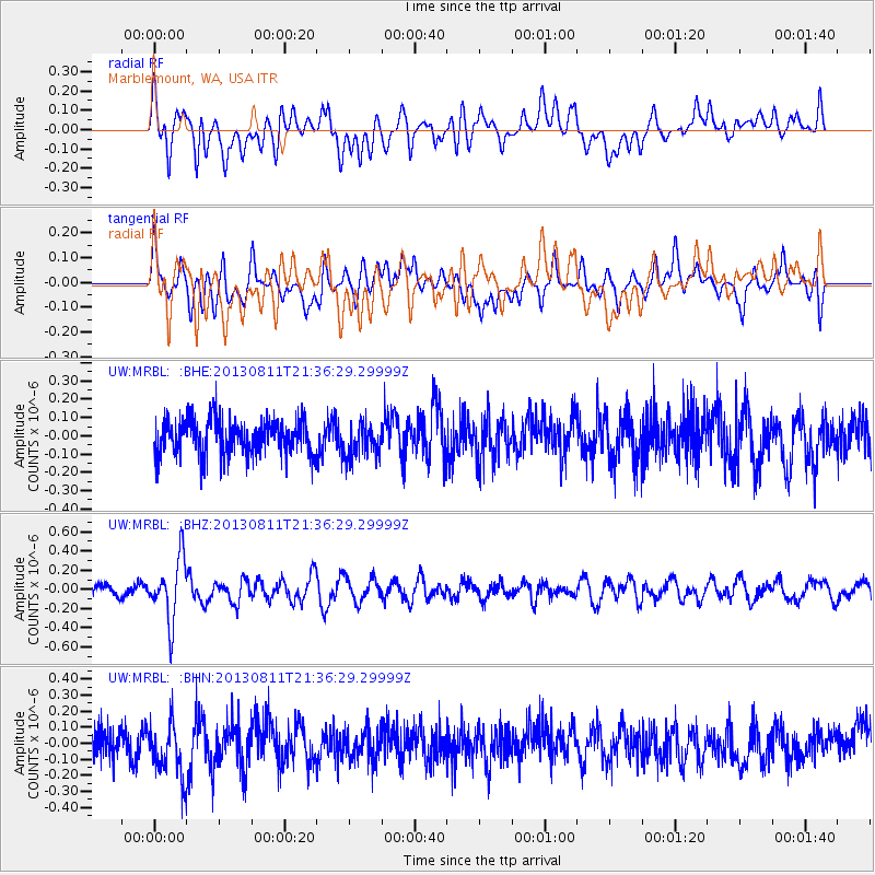
MRBL Marblemount, WA, USA - Earthquake Result Viewer
*The percent match for this event was below the threshold and hence no stack was calculated.
| Earthquake location: |
Xizang |
| Earthquake latitude/longitude: |
30.0/98.0 |
| Earthquake time(UTC): |
2013/08/11 (223) 21:23:41 GMT |
| Earthquake Depth: |
6.0 km |
| Earthquake Magnitude: |
5.7 MWW, 5.6 MWB, 5.7 MWW, 5.8 MWC |
| Earthquake Catalog/Contributor: |
NEIC PDE/NEIC COMCAT |
|
| Network: |
UW Pacific Northwest Regional Seismic Network |
| Station: |
MRBL Marblemount, WA, USA |
| Lat/Lon: |
48.52 N/121.48 W |
| Elevation: |
75 m |
|
| Distance: |
94.2 deg |
| Az: |
25.057 deg |
| Baz: |
326.474 deg |
| Ray Param: |
$rayparam |
*The percent match for this event was below the threshold and hence was not used in the summary stack. |
|
| Radial Match: |
54.483032 % |
| Radial Bump: |
400 |
| Transverse Match: |
44.82356 % |
| Transverse Bump: |
400 |
| SOD ConfigId: |
626651 |
| Insert Time: |
2014-04-17 21:23:40.507 +0000 |
| GWidth: |
2.5 |
| Max Bumps: |
400 |
| Tol: |
0.001 |
|
Signal To Noise
| Channel | StoN | STA | LTA |
| UW:MRBL: :BHZ:20130811T21:36:29.29999Z | 4.9468937 | 3.178138E-7 | 6.424512E-8 |
| UW:MRBL: :BHN:20130811T21:36:29.29999Z | 1.6456399 | 1.6789873E-7 | 1.0202641E-7 |
| UW:MRBL: :BHE:20130811T21:36:29.29999Z | 0.99835086 | 9.6303985E-8 | 9.646307E-8 |
| Arrivals |
| Ps | |
| PpPs | |
| PsPs/PpSs | |


