You are here: Home > Network List > AK - Alaska Regional Network Stations List
> Station MDM Murphy Dome > Earthquake Result Viewer
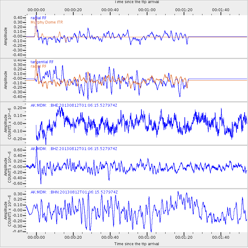
MDM Murphy Dome - Earthquake Result Viewer
*The percent match for this event was below the threshold and hence no stack was calculated.
| Earthquake location: |
Banda Sea |
| Earthquake latitude/longitude: |
-7.1/129.8 |
| Earthquake time(UTC): |
2013/08/12 (224) 00:53:43 GMT |
| Earthquake Depth: |
95 km |
| Earthquake Magnitude: |
6.0 MWW, 6.0 MWW, 6.1 MWB, 6.1 MWC |
| Earthquake Catalog/Contributor: |
NEIC PDE/NEIC COMCAT |
|
| Network: |
AK Alaska Regional Network |
| Station: |
MDM Murphy Dome |
| Lat/Lon: |
64.96 N/148.23 W |
| Elevation: |
634 m |
|
| Distance: |
93.0 deg |
| Az: |
24.962 deg |
| Baz: |
259.728 deg |
| Ray Param: |
$rayparam |
*The percent match for this event was below the threshold and hence was not used in the summary stack. |
|
| Radial Match: |
65.906685 % |
| Radial Bump: |
400 |
| Transverse Match: |
53.923393 % |
| Transverse Bump: |
400 |
| SOD ConfigId: |
626651 |
| Insert Time: |
2014-04-17 21:26:35.720 +0000 |
| GWidth: |
2.5 |
| Max Bumps: |
400 |
| Tol: |
0.001 |
|
Signal To Noise
| Channel | StoN | STA | LTA |
| AK:MDM: :BHZ:20130812T01:06:15.527974Z | 3.9258773 | 2.819582E-7 | 7.182042E-8 |
| AK:MDM: :BHN:20130812T01:06:15.527974Z | 1.3198733 | 1.235435E-7 | 9.360254E-8 |
| AK:MDM: :BHE:20130812T01:06:15.527974Z | 0.68298495 | 7.0716105E-8 | 1.0353977E-7 |
| Arrivals |
| Ps | |
| PpPs | |
| PsPs/PpSs | |


