You are here: Home > Network List > IU - Global Seismograph Network (GSN - IRIS/USGS) Stations List
> Station FURI Mt. Furi, Ethiopia > Earthquake Result Viewer
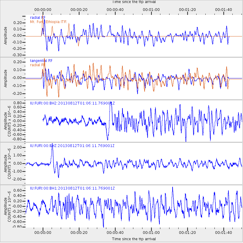
FURI Mt. Furi, Ethiopia - Earthquake Result Viewer
*The percent match for this event was below the threshold and hence no stack was calculated.
| Earthquake location: |
Banda Sea |
| Earthquake latitude/longitude: |
-7.1/129.8 |
| Earthquake time(UTC): |
2013/08/12 (224) 00:53:43 GMT |
| Earthquake Depth: |
95 km |
| Earthquake Magnitude: |
6.0 MWW, 6.0 MWW, 6.1 MWB, 6.1 MWC |
| Earthquake Catalog/Contributor: |
NEIC PDE/NEIC COMCAT |
|
| Network: |
IU Global Seismograph Network (GSN - IRIS/USGS) |
| Station: |
FURI Mt. Furi, Ethiopia |
| Lat/Lon: |
8.90 N/38.68 E |
| Elevation: |
2570 m |
|
| Distance: |
92.2 deg |
| Az: |
278.636 deg |
| Baz: |
96.835 deg |
| Ray Param: |
$rayparam |
*The percent match for this event was below the threshold and hence was not used in the summary stack. |
|
| Radial Match: |
66.01419 % |
| Radial Bump: |
400 |
| Transverse Match: |
59.680546 % |
| Transverse Bump: |
400 |
| SOD ConfigId: |
626651 |
| Insert Time: |
2014-04-17 21:34:44.109 +0000 |
| GWidth: |
2.5 |
| Max Bumps: |
400 |
| Tol: |
0.001 |
|
Signal To Noise
| Channel | StoN | STA | LTA |
| IU:FURI:00:BHZ:20130812T01:06:11.769001Z | 3.010273 | 3.4754007E-7 | 1.1545134E-7 |
| IU:FURI:00:BH1:20130812T01:06:11.769001Z | 1.635432 | 1.9051848E-7 | 1.1649428E-7 |
| IU:FURI:00:BH2:20130812T01:06:11.769001Z | 1.0587343 | 1.08418014E-7 | 1.0240342E-7 |
| Arrivals |
| Ps | |
| PpPs | |
| PsPs/PpSs | |


